Area Overview for Great Blakenham
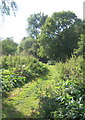
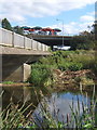
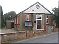
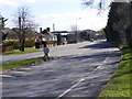
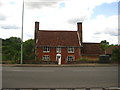
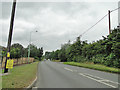
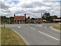
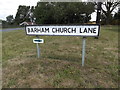
Photos of Great Blakenham


Area Information
Great Blakenham is a small built-up area in England, covering just 1.1 km², yet it offers a distinct character shaped by its demographics and connectivity. With a median age of 70, the community here is predominantly older, suggesting a settled population with long-term ties to the area. The 80% home ownership rate indicates a stable housing market, with most residents living in properties they own. Daily life is influenced by the proximity to key amenities: five retail outlets, including Budgens and Lidl, and five rail stations, such as Needham Market Railway Station, provide practical access to shopping and commuting. The nearby RAF Wattisham airport adds a unique layer to the area’s profile, though its civilian utility is unclear. For those prioritising safety, Great Blakenham’s low crime risk score of 83 makes it an appealing choice. While the area’s compact size may limit options, its combination of accessibility, safety, and established community makes it a viable option for those seeking a quieter, well-connected home.
- Area Type
- Built Up Area 250
- Area Size
- 1.1 km²
- Population
- Not available
- Population Density
- Not available
Residents of Great Blakenham benefit from a range of nearby amenities that cater to everyday needs. Five retail outlets, including Budgens and Lidl, provide access to groceries and convenience stores, ensuring essentials are within easy reach. The presence of five rail stations, such as Needham Market Railway Station, facilitates commuting to larger towns or cities, while the RAF Wattisham airport, though likely military-focused, adds a layer of connectivity for specific travel needs. While the data does not mention parks or leisure facilities, the retail and transport options suggest a practical, no-frills lifestyle. The compact nature of the area means amenities are concentrated, reducing travel time for routine errands. For those valuing convenience over expansive leisure options, Great Blakenham’s layout offers a straightforward, accessible daily life. The absence of detailed information on recreational spaces means buyers should investigate further, but the existing infrastructure supports a functional, efficient lifestyle.
Amenities
Schools
| Rank | A + A* % | School | Type | Entry gender | Ages |
|---|
Explore more schools in this area
Go to Schools tabDemographics
The population of Great Blakenham skews significantly towards older residents, with a median age of 70. This suggests a community where retirement is the primary life stage, which may influence local services and social dynamics. Home ownership is high, at 80%, indicating a strong preference for long-term residency over rental properties. The data does not specify household composition or ethnic diversity, but the ‘total’ category for these fields implies broad representation. The absence of detailed breakdowns means assumptions about the area’s social fabric must remain cautious. However, the age profile and ownership figures together suggest a mature, stable population with established routines. For prospective buyers, this demographic may translate to a quieter, less transient environment, though it also means fewer amenities tailored to younger families. The lack of specific figures on deprivation or diversity means these factors cannot be assessed, but the overall profile hints at a community prioritising stability over rapid change.
Household Size
Accommodation Type
Tenure
Ethnic Group
Religion
Household Composition
Age
Household Deprivation
NS-SEC
Explore more demographic insights in this area
Go to Demographics tabPlanning
Planning Constraints
- Crime RiskLocked