Area Overview for Goat Hall Ward
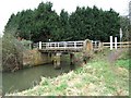
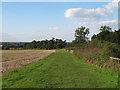
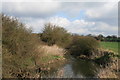
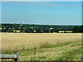
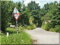
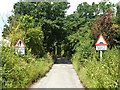
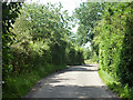
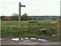
Photos of Goat Hall Ward
Area Information
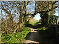
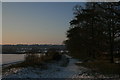
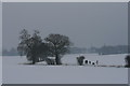
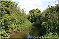
Living in Goat Hall Ward offers a distinct character within Chelmsford City Council, situated in Essex. This electoral ward encompasses the largest area within the Chelmsford urban boundary while incorporating a large swathe of open countryside to the southwest of the city centre. The location lies to the west of the borough, encompassing residential zones around Galleywood. You will find postcodes such as CM2 8XZ, CM2 8XY, and CM2 8XS defining the postcode districts in this region. The area is home to Goat Hall, a listed building located in Galleywood, which serves as a historic anchor for the neighbourhood. Daily life here balances the convenience of urban proximity with the quiet of rural openness. The ward profile indicates a significant amount of land coverage relative to other wards in the city. Residents navigate an environment where established residential pockets meet expansive green spaces. This mix supports a lifestyle that requires transport links for city access yet values the availability of local countryside for recreation. The specific geography of this district sets it apart from entirely suburban or completely rural zones. Understanding the layout of these specific ward boundaries helps you assess your potential commuting routes. The presence of the listed building adds historical depth to the modern infrastructure supporting Galleywood today.
- Area Type
- District Borough Unitary Ward
- Area Size
- 4.0 km²
- Population
- Not available
- Population Density
- Not available
Demographics
The community profile of Goat Hall Ward reflects a settled population with defined demographic characteristics. The median age in the area stands at 70 years, indicating a significant proportion of older residents living in this ward. This age profile suggests a community where long-term residents remain in their homes rather than young families moving in for new opportunities. Home ownership is extensive, with 85% of households owning their property. This high level of equity suggests stability and a deep-rooted connection to the locality. You are less likely to encounter short-term tenancy or fluctuating tenancy situations when evaluating the neighbourhood. The household composition and accommodation type data are recorded as totals, confirming the aggregate nature of the demographic statistics available. The section on predominant ethnicity and religion is similarly classified under total data categories, meaning specific breakdowns for these groups are not detailed in the current records. Deprivation pressures do not appear as a highlighted factor in the provided assessments, allowing the neighbourhood to focus on other attributes for appeal. The high ownership rate often correlates with lower turnover and a slower pace of change within the streets. This demographic reality means that new services may adapt slowly to changing needs, but maintenance of existing facilities tends to be reliable.
Household Size
Accommodation Type
Tenure
Ethnic Group
Religion
Household Composition
Age
Household Deprivation
NS-SEC
Explore more demographic insights in this area
Go to Demographics tabPlanning
Planning Constraints
- Flood RiskPremium
- Ramsar Wetland SitesPremium
- Area of Outstanding Natural BeautyPremium
- Protected Nature ReservePremium
- Protected WoodlandPremium
- Crime RiskPremium