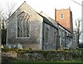
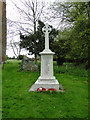
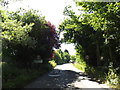
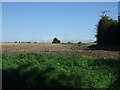
Area Overview for Gislingham
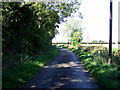
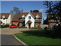
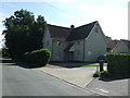
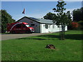
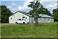
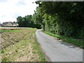
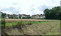
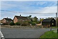
Photos of Gislingham
Area Information
Gislingham is a compact built-up area spanning 48.6 hectares, nestled in the heart of England. Its character is defined by a mature population, with a median age of 70, suggesting a community rooted in stability and long-term residency. The area is home to a mix of housing types, with 81% of properties owned by residents, reflecting a strong sense of local attachment. Daily life here is shaped by proximity to essential services, including a railway station and several retail outlets, while the presence of two primary schools underscores its appeal to families. Though small in size, Gislingham offers a blend of practicality and quiet living, with amenities within practical reach. Its low crime risk and established infrastructure make it a viable choice for those seeking a settled, low-maintenance environment. For buyers, the area’s compact nature means everything is within walking or short driving distance, reducing the need for extensive commutes. Gislingham’s appeal lies in its simplicity: a place where convenience meets community.
- Area Type
- Built Up Area 250
- Area Size
- 48.6 hectares
- Population
- Not available
- Population Density
- Not available
Gislingham’s lifestyle is shaped by its proximity to essential amenities, including five retail outlets such as Co-op Rickinghall, East of England Co-operative Co, and Co-op Eye. These stores provide access to groceries, household supplies, and other daily necessities, reducing the need for long trips to larger centres. The Diss Railway Station adds to the area’s connectivity, enabling travel to nearby towns and cities. While the data does not specify parks or leisure facilities, the presence of retail and transport options suggests a community focused on practicality. The compact nature of Gislingham means that residents can access shops, services, and transport within short distances, fostering a convenient, low-maintenance lifestyle. The mix of retail and transport infrastructure supports both everyday needs and occasional travel, making the area suitable for those prioritising accessibility over expansive recreational spaces.
Amenities
Schools
Gislingham is served by two primary schools, both affiliated with the Church of England. The first is Gislingham Church of England Voluntary Controlled Primary School, while the second, Gislingham Church of England Primary School, holds a 'good' Ofsted rating. These institutions cater to younger families, offering a mix of religious and educational oversight. The presence of two primary schools within the area ensures that children have access to schooling without the need for long commutes. For families prioritising education, the 'good' rating at one school provides a benchmark of quality, though the absence of secondary schools or additional educational facilities is not specified in the data. The dual presence of primary schools reflects Gislingham’s role as a community focused on family needs, with education being a central consideration for residents.
| Rank | A + A* % | School | Type | Entry gender | Ages |
|---|---|---|---|---|---|
| 1 | N/A | Gislingham Church of England Voluntary Controlled Primary School | primary | N/A | N/A |
| 2 | N/A | Gislingham Church of England Primary School | primary | N/A | N/A |
Explore more schools in this area
Go to Schools tabDemographics
The population of Gislingham is predominantly older, with a median age of 70, indicating a community largely composed of retired individuals or long-term residents. Home ownership is high, at 81%, suggesting a stable, owner-occupied demographic. While specific data on household composition or accommodation types is not provided, the overall profile points to a mature, low-turnover population. The area’s demographics do not include detailed information on ethnic diversity or deprivation levels, but the high home ownership rate implies a relatively affluent or self-sufficient community. This age profile may influence local services and amenities, with a focus on accessibility and ease of living. For prospective buyers, the demographic suggests a neighbourhood where property values may be resilient to fluctuation, given the established nature of the population.
Household Size
Accommodation Type
Tenure
Ethnic Group
Religion
Household Composition
Age
Household Deprivation
NS-SEC
Explore more demographic insights in this area
Go to Demographics tabPlanning
Planning Constraints
- Crime RiskLocked