Area Overview for Girton
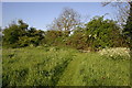
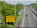
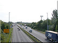
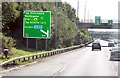
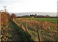
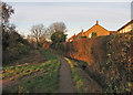
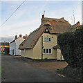
Photos of Girton
Area Information
Girton is a compact built-up area spanning 1.6 km², situated in England. Its population, while not explicitly stated, is reflected in its demographic profile, with a median age of 70, suggesting a community skewed towards older residents. The area’s proximity to Cambridge North Railway Station and Waterbeach Station offers straightforward access to the city and beyond, while nearby schools like Girton Glebe Primary and Gretton School cater to families. Daily life here balances quiet residential living with practical amenities, including retail options such as Co-op Girton and Sainsburys Cambridge. The high broadband score of 99 ensures seamless internet connectivity, supporting both remote work and leisure. With 70% of homes owner-occupied, Girton feels stable, though its character is defined by the presence of special schools and a focus on accessibility. For those seeking a low-crime, well-connected environment with a mix of local services, Girton offers a distinct blend of convenience and tranquillity.
- Area Type
- Built Up Area 250
- Area Size
- 1.6 km²
- Population
- Not available
- Population Density
- Not available
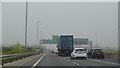
Girton’s lifestyle is shaped by its accessible amenities. Within walking or short driving distance are five retail outlets, including Co-op Girton, Sainsburys Cambridge, and Tesco Orchard, ensuring everyday shopping needs are met. The presence of two railway stations provides easy access to Cambridge and beyond, while proximity to Cambridge Airport (listed twice in the data) may offer travel convenience for those requiring air travel. Though parks or leisure facilities are not explicitly named, the area’s compact size suggests a focus on local services over expansive recreational spaces. The mix of retail, transport, and nearby educational institutions creates a practical, community-oriented environment where daily life is efficient and well-supported.
Amenities
Schools
Girton is served by a range of schools, including Girton Glebe Primary School, which holds a “good” Ofsted rating, and Gretton School, a special school with an “outstanding” rating. Other special schools in the area include Littleton House School and The Lady Adrian Special School. This mix of primary and special educational institutions reflects the community’s needs, offering support for both general and specialist education. Families with children requiring special needs provision will find Gretton School’s high rating particularly reassuring. The presence of multiple schools within practical reach ensures accessibility for residents, though the absence of secondary schools may require commuting for older students. The quality of education here is clearly a priority, with at least one school performing exceptionally well.
| Rank | A + A* % | School | Type | Entry gender | Ages |
|---|---|---|---|---|---|
| 1 | N/A | Girton Glebe Primary School | primary | N/A | N/A |
| 2 | N/A | Littleton House School | special | N/A | N/A |
| 3 | N/A | The Lady Adrian Special School | special | N/A | N/A |
| 4 | N/A | Gretton School | special | N/A | N/A |
| 5 | N/A | Girton Glebe Primary School | primary | N/A | N/A |
Explore more schools in this area
Go to Schools tabDemographics
Girton’s population has a median age of 70, indicating a community predominantly composed of older residents. The most common age range is listed as “Age: Total,” which may reflect aggregated data rather than a specific group. Home ownership stands at 70%, suggesting a majority of residents live in their own homes rather than renting. Household composition and accommodation types are reported as “total,” meaning no breakdown is available for family structures or property types. The area’s ethnic and religious diversity is similarly summarised as “total,” offering no granular insight into cultural or demographic composition. While this data lacks detail, the high home ownership rate implies a settled population, which can contribute to a stable community environment. However, without further specifics, it is difficult to assess the area’s social dynamics or diversity in depth.
Household Size
Accommodation Type
Tenure
Ethnic Group
Religion
Household Composition
Age
Household Deprivation
NS-SEC
Explore more demographic insights in this area
Go to Demographics tabPlanning
Planning Constraints
- Crime RiskLocked