Area Overview for Gilston
Photos of Gilston

Area Information
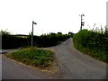
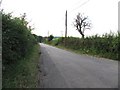
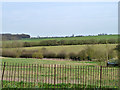
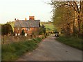
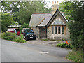
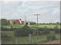
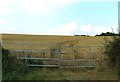
Gilston is a civil parish in East Hertfordshire that offers a distinct rural residential character approximately one mile from Harlow town centre. The parish covers an area of 3.9 square kilometres, bounded on the south by the River Stort, which also marks the county line between Hertfordshire and Essex. While the population recorded at the 2021 census stood at 777, local research suggests the postcodes within this vicinity support a community of approximately 2,205 residents. You live in a setting defined by historic charm and countryside views rather than urban density. The village maintains a quiet atmosphere centred around landmarks such as the 12th-century St Mary's Church and the Grade II* listed Gilston Park. Despite its rural nature, you are positioned for easy access to broader regional infrastructure. Harlow serves as the primary post town and provides most daily amenities, while the historic Plume of Feathers Inn anchors the village square. This location suits those seeking to combine the space of a village with quick travel links to London and Cambridge via the nearby M11 and A10 motorways.
- Area Type
- Parish
- Area Size
- 3.9 km²
- Population
- Not available
- Population Density
- Not available
Demographics
The community in Gilston reflects a settled population with a median age of 70 years. This demographic profile indicates that the area attracts older residents who value a quiet neighbourhood close to the countryside. You are likely to find a majority owner-occupier base, with statistics showing that 77 per cent of households own their homes outright or with a mortgage. The remaining households consist of renters or shared ownership units, though specific data on slavery-type or private rental tenure is not detailed in current records. The village lacks the young professional split commonly found in satellite towns, suggesting a stable, established community rather than a transient one. Ethnic diversity and religious affiliation statistics are not broken down in the available information for this specific parish, meaning the local feel is shaped primarily by age and tenure rather than complex demographic segmentations. Living in Gilston means joining a community where long-term residents dominate the social landscape, creating a predictable environment for families or those planning their retirement years.
Household Size
Accommodation Type
Tenure
Ethnic Group
Religion
Household Composition
Age
Household Deprivation
NS-SEC
Explore more demographic insights in this area
Go to Demographics tabPlanning
Planning Constraints
- Flood RiskPremium
- Ramsar Wetland SitesPremium
- Area of Outstanding Natural BeautyPremium
- Protected Nature ReservePremium
- Protected WoodlandPremium