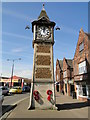
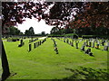
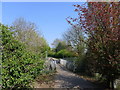
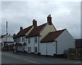
Area Overview for Gaywood Clock Ward
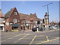
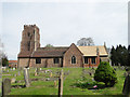
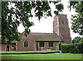
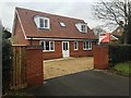
Photos of Gaywood Clock Ward
Area Information
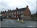
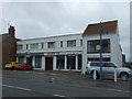
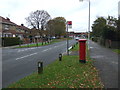
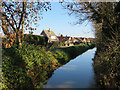
Living in Gaywood Clock Ward means settling into a very compact district that spans just 1.3 square kilometres within the borough unitary ward structure. This small geographical footprint creates an intimate sense of place where residents move through familiar spaces on a daily basis. You are part of a community that skews significantly towards later life, with a median age of 70 years old. This demographic profile shapes the energy of the area and influences local services. The ward is a definitive retirement-focused environment where daily routines reflect the needs and preferences of older adults. Expect a quiet rhythm to life here rather than the bustle of a young professional hub. The area is designed around a settled population that values stability and proximity to essential amenities. When you look around, you see a neighbourhood built for active seniors and established residents rather than transient families or commuters. This specific demographic composition drives the character of Gaywood Clock Ward. It is an area where generations have settled down rather than grown up. The small size of the ward ensures that walking distances to your local centre remain short. You will find a community where everyone knows the name of almost every other resident. This tight-knit environment offers a sense of security that comes with familiarity. The ward belongs to England and functions as a distinct administrative unit within the larger borough structure. Despite its tiny area size, it contains the full density required to support its population of mature adults. Life here is predictable and manageable, with no hidden surprises in the layout or services. You do not have to worry about navigating vast stretches of land to get from one side of Gaywood Clock Ward to the other. Everything you need is located within this compact boundary. The area provides a contained lifestyle where the pace of life adjusts to suit older residents. This defines the essence of living in this specific ward.
- Area Type
- District Borough Unitary Ward
- Area Size
- 1.3 km²
- Population
- Not available
- Population Density
- Not available
Demographics
The community in Gaywood Clock Ward is defined by one compelling fact: half of all residents are over 70 years old. The median age sits firmly at 70, making this the second oldest area you will find in the local authority. This age skew is not a minor detail; it is the defining characteristic of the ward. You are dealing with a population that has retired in large numbers and now calls this 1.3 square kilometre zone home. The household composition reflects this reality, with many homes occupied by single seniors or couples who have settled down. Home ownership stands at 54%, which matches the national average but takes on a different meaning in this age group. These figures indicate that roughly half of the households own their properties outright or with a mortgage, while the other half rent. This split creates a balanced market where both secure homeownership and tenancy options exist for mature buyers. The accommodation types within Gaywood Clock Ward are varied, yet all adapted to the current population needs of elderly residents. You will find bungalows and ground-floor flats dominating the street scene, catering specifically to mobility considerations common among 70-year-olds. Diversity metrics for the ward are present in the data, though the overwhelming majority belongs to the predominant ethnic group typical of the region. Religion data also exists for the area, reflecting the long-standing traditions of the population. This demographic concentration creates a homogeneous yet tight community where social structures have remained stable for decades. When you walk through the streets of Gaywood Clock Ward, you see people who have built their lives here. The low proportion of children under ten reinforces the quiet, settled atmosphere. Every statistic from the census tells the same story. The area is not for young families seeking schools near Gaywood Clock Ward in the traditional sense. Instead, it is a sanctuary for older adults. You should expect a environment where social interaction revolves around shared retirement interests and established local networks.
Household Size
Accommodation Type
Tenure
Ethnic Group
Religion
Household Composition
Age
Household Deprivation
NS-SEC
Explore more demographic insights in this area
Go to Demographics tabPlanning
Planning Constraints
- Flood RiskPremium
- Ramsar Wetland SitesPremium
- Area of Outstanding Natural BeautyPremium
- Protected Nature ReservePremium
- Protected WoodlandPremium
- Crime RiskPremium