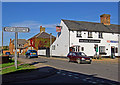
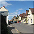
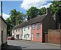
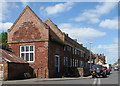
Area Overview for Gamlingay
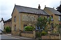
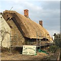
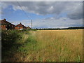
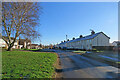
Photos of Gamlingay


Area Information
Gamlingay is a built-up area in England covering 91.9 hectares, offering a compact yet well-defined living environment. With a median age of 70, the community here is predominantly older, suggesting a settled population with established roots. Daily life in Gamlingay is shaped by its proximity to local amenities and transport links, making it practical for residents who value convenience. The area’s character is defined by its mix of retail options, including Co-op Gamlingay and Morrisons Daily Sandy 6, and accessible rail stations such as Sandy and Biggleswade. For families, the presence of multiple schools, from primary institutions like Gamlingay Village Primary to independent options such as the Children’s Montessori School, ensures varied educational choices. Gamlingay’s appeal lies in its balance of quiet living with essential services nearby, though its demographic profile indicates a community that may lean towards retirement or long-term residency rather than a younger, growing population.
- Area Type
- Built Up Area 250
- Area Size
- 91.9 hectares
- Population
- Not available
- Population Density
- Not available
Gamlingay’s lifestyle is shaped by its accessible amenities, including retail options such as Co-op Gamlingay, Tesco Potton, and Morrisons Daily Sandy 6. These shops provide everyday essentials, supporting a practical approach to daily living. The presence of three railway stations—Sandy, Biggleswade, and St Neots—enhances mobility, allowing residents to travel easily to nearby towns. While the area does not include detailed information on parks or leisure facilities, the availability of local shops and transport links suggests a community focused on convenience. The mix of retail and transport options contributes to a lifestyle that balances local independence with regional connectivity, making Gamlingay suitable for those who prioritise ease of access over expansive leisure opportunities.
Amenities
Schools
Gamlingay offers a selection of educational institutions, including primary schools such as Gamlingay Village Primary and Gamlingay First School, as well as an academy, Gamlingay Village College. An independent option, the Children’s Montessori School at the Old Social Club, provides an alternative for families seeking non-state-run education. The variety of school types ensures that parents have choices based on their preferences for curriculum, teaching methods, and community values. While Ofsted ratings for these schools are not provided, the presence of multiple institutions suggests a focus on education within the area. Families with children may benefit from the proximity of these schools, though the specific quality of education would require further local research.
| Rank | School | Type | Entry gender | Ages |
|---|
Explore more schools in this area
Go to Schools tabDemographics
The population of Gamlingay has a median age of 70, indicating a community that is largely composed of older adults. This age profile suggests a demographic that may be more established, with fewer children or younger families compared to other areas. Home ownership in Gamlingay stands at 76%, reflecting a strong presence of owner-occupied properties. While the data does not specify household composition or accommodation types in detail, the high home ownership rate implies a stable housing market with fewer rental properties. The area’s predominant ethnic group and religious composition are not detailed, but the overall demographic is shaped by the age distribution and ownership patterns. This profile may influence the social dynamics of the area, with a focus on community continuity rather than rapid change.
Household Size
Accommodation Type
Tenure
Ethnic Group
Religion
Household Composition
Age
Household Deprivation
NS-SEC
Explore more demographic insights in this area
Go to Demographics tabPlanning
Planning Constraints
- Crime RiskPremium