Area Overview for Gainsborough Ward
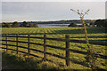
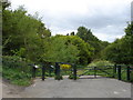
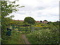
Photos of Gainsborough Ward


Area Information
Living in Gainsborough Ward offers a place defined by its small administrative boundaries and tranquil environment. This district borough unitary ward covers an area of exactly 3.6 square kilometres. A population of 1,481 residents calls this space home, creating a very low-density lived experience. With a population density of just 406 people per square kilometre, the area lacks the noise and congestion often found in larger urban centres. You will find a settlement that prioritises open space and calm over commercial bustle. Daily life here moves at a deliberate pace. The sheer size of the ward relative to its inhabitants means that travel distances between your home and local amenities are typically short. This quiet setting appeals to those seeking a retreat from city living rather than a bustling metropolitan hub. The ward represents a specific slice of North Lincolnshire where nature and low population pressure dominate the character of the community. Your everyday neighbours will be few, resulting in a non-gated, close-knit but sparse social fabric. This is not a location for high-octane urban living. It is a preserved environment where the landscape takes precedence over infrastructure.
- Area Type
- District Borough Unitary Ward
- Area Size
- 3.6 km²
- Population
- 1481
- Population Density
- 406 people/km²
Demographics
The community within Gainsborough Ward is distinguished by a significantly older age profile compared to the national average. The median age for residents is 70 years old. This demographic reality shapes almost every aspect of life in the area. The most common age range recorded for the total population reflects this shift towards retirement and senior living. Consequently, services and social interactions cater primarily to older adults and their needs. Home ownership stands as the dominant housing tenure in Gainsborough Ward. You will find that 57% of households own their properties outright or with a mortgage. This indicates a stable, settled population rather than a transient rental sector. The area does not feature a high concentration of private rented accommodation or student living blocks. Household composition data for the total population confirms that families often consist of older couples or single seniors. There is no specific data provided regarding the predominant ethnic group or predominant religion within the ward. These statistics are not included in the current records. Deprivation data is also absent from the available information for this ward. The primary defining feature of the resident profile remains the high median age and the majority owner-occupied status.
Household Size
Accommodation Type
Tenure
Ethnic Group
Religion
Household Composition
Age
Household Deprivation
NS-SEC
Explore more demographic insights in this area
Go to Demographics tabPlanning
Planning Constraints
- Flood RiskPremium
- Ramsar Wetland SitesPremium
- Area of Outstanding Natural BeautyPremium
- Protected Nature ReservePremium
- Protected WoodlandPremium
- Crime RiskPremium