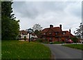
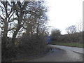
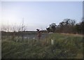
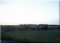
Area Overview for Furneux Pelham
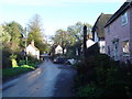
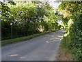
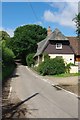
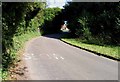
Photos of Furneux Pelham
Area Information
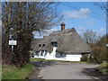
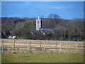
Furneux Pelham is a small civil parish covering 10.3 square kilometres, offering a quiet rural setting for those seeking a slower pace of life. You will find that daily life here is defined by a lack of urban congestion, making it suitable for residents who prioritise space and tranquillity. The community acts as a secure base for commuters and retirees alike, providing a stable environment away from the rush of major cities. The parish size suggests that you will have easy access to open spaces, yet remain close enough to access wider regional services. This location stands out for its manageable scale, which fosters a close-knit atmosphere without the density of a town centre. You should expect a lifestyle where the boundaries between nature and residential zones are minimal, allowing for significant outdoor engagement. The area's classification as a parish confirms its established local governance and community cohesion. For anyone considering a retreat to the countryside, the geography supports a tranquil existence. It is a place where the focus remains on the land and the quiet rhythms of rural living rather than commercial activity or high-density development.
- Area Type
- Parish
- Area Size
- 10.3 km²
- Population
- Not available
- Population Density
- Not available
Demographics
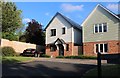
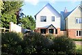
The community in Furneux Pelham displays a distinct demographic profile, with a median age of 70 years. This figure indicates that the majority of residents are seniors or retired individuals. The most common age range spans the entire population breadth, reinforcing the status of this area as a retirement destination. You will encounter very few young families or children in the local environment, which means noise levels remain consistently low. Household composition reflects this older demographic, resulting in single-occupancy households being the norm. With a home ownership rate of 77%, nearly four out of five residents own their properties outright. This high proportion of owner-occupiers creates a financially stable neighbourhood where people have invested in their localities for the long term. Accommodation types align with this ownership structure, featuring a majority of dwellings held by their occupants rather than landlords. While the data does not specify ethnic diversity or religious details, the strong ownership figures suggest a community where residents have deep roots. Living here offers privacy and quiet, though you should note that the social fabric may cater primarily to the needs and interests of older generations.
Household Size
Accommodation Type
Tenure
Ethnic Group
Religion
Household Composition
Age
Household Deprivation
NS-SEC
Explore more demographic insights in this area
Go to Demographics tabPlanning
Planning Constraints
- Flood RiskPremium
- Ramsar Wetland SitesPremium
- Area of Outstanding Natural BeautyPremium
- Protected Nature ReservePremium
- Protected WoodlandPremium
- Crime RiskPremium