Area Overview for Fritton and St. Olaves
Photos of Fritton and St. Olaves
Area Information
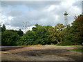
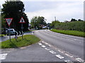
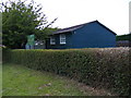
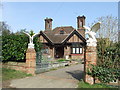
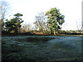
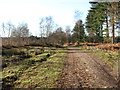
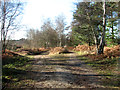
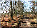
Fritton and St. Olaves is a small civil parish situated in Norfolk, covering an area of 7.6 square kilometres. Living in Fritton and St. Olaves offers a quiet rural existence far from the pressures of major urban centres. The locality maintains a distinct character without the constraints of protected designations such as Areas of Outstanding Natural Beauty or Ramsar wetland sites. This absence of planning restrictions suggests a focused development landscape within the parish boundaries. Residents enjoy a specific type of peace that comes with a rural parish homestead community. The area provides a defined space for those seeking a settled lifestyle away from city noise. You will find that daily life here revolves around local convenience and natural surroundings rather than bustling commercial hubs. The parish operates independently as a distinct entity within the wider county structure. Understanding the scale of the parish at under eight square kilometres helps you grasp the intimacy of the local environment. This setting shapes the rhythm of everyday activities for everyone calling Fritton and St. Olaves their home.
- Area Type
- Parish
- Area Size
- 7.6 km²
- Population
- Not available
- Population Density
- Not available
Demographics
The community profile within Fritton and St. Olaves reveals a predominantly older population. Data from the area indicates a median age of 70, which places the neighbourhood well into senior demographics territory. Most families you encounter are likely retired couples or elderly individuals enjoying a slowing pace of life. Home ownership defines the architectural and social fabric, with 87 per cent of occupied properties in your hands. This high ownership rate creates a stable environment where residents have long-standing ties to their homes. The household composition across the total area reflects this ageing trend rather than young households or families with children. You will notice very little presence of modes of living that rely on high-mobility infrastructure given the demographic skew. The ethnic and religious breakdown of the total population remains consistent with national averages but lacks detailed specific statistics for the parish. Deprivation metrics do not feature prominently in the local narrative, suggesting a relatively uniform standard of living across the board. When considering who lives here, the primary market consists of established owners rather than transitory renters. This stability means neighbours are unlikely to change addresses frequently.
Household Size
Accommodation Type
Tenure
Ethnic Group
Religion
Household Composition
Age
Household Deprivation
NS-SEC
Explore more demographic insights in this area
Go to Demographics tabPlanning
Planning Constraints
- Flood RiskPremium
- Ramsar Wetland SitesPremium
- Area of Outstanding Natural BeautyPremium
- Protected Nature ReservePremium
- Protected WoodlandPremium
- Crime RiskPremium