Area Overview for Friston
Photos of Friston
Area Information
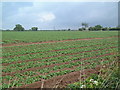
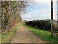
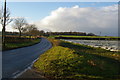
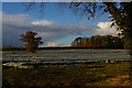
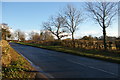
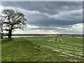
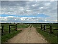
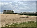
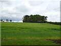
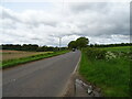
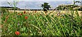
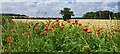
Living in Friston offers a quiet life within a civil parish that spans 11.8 square kilometres. This location exists in the rural heart of England, far removed from the noise and pace of city living. The area provides a sense of isolation suited to those seeking tranquility rather than urban convenience. You will find yourself surrounded by open spaces where the primary focus is on nature and privacy. The landscape here dictates the lifestyle, meaning daily routines involve walking distances rather than short trips to a shop down the road. The town itself is small, defined more by its boundaries than its population density. Buyers looking for a restful environment will appreciate the lack of traffic and the steady, unchanging character of the parish. There are no large commercial centres to disrupt the peace, ensuring that mornings begin without alarm bells. This setting appeals to individuals who value stillness and wish to disconnect from the fast rhythm of modern metropolitan life. Every day in Friston moves at a slower pace. The environment encourages you to slow down and notice the details of your surroundings. The limited scale means there is nowhere to hide, fostering a transparent and straightforward neighbourhood dynamic. You move through the parish with a clear view of what lies ahead, fostering a deep connection to the land. This is a place where life is measured in footsteps across the fields rather than minutes spent waiting for transport. For families or retirees, the layout supports an existence centred on home and local connections. The absence of complex infrastructure means you become the planner of your own leisure and activity. Owning a home here integrates you with the land itself, as the property and the surrounding 11.8 square kilometres form a single, cohesive unit. This simplicity allows residents to focus entirely on their immediate environment.
- Area Type
- Parish
- Area Size
- 11.8 km²
- Population
- Not available
- Population Density
- Not available
Demographics
The community of Friston displays a very specific age profile. The median age is 70, indicating that the majority of residents are older adults. Most people in this area fall into categories typical of retirement or late adulthood. This demographic reality creates a quiet neighbourhood where social interactions often revolve around long-term residents. Consequently, the area feels established and stable, with long-standing roots in the local history. Home ownership stands at an impressive 78% within the parish. This high figure suggests that most people living in Friston have purchased their properties or inherited them. Financial ties to the area are deep, as residents own their land rather than renting it. This extensive rate of ownership contributes significantly to the stability of the community. Tenancy offers a transient lifestyle, whereas the 78% who own homes provide a settled presence. The accommodation stock reflects this ownership pattern, dominated by family homes rather than rental schemes. You are likely to find traditional detached or semi-detached houses rather than purpose-built apartment blocks. The housing represents a significant investment for the residents, reinforcing their commitment to staying in the parish for the foreseeable future. This structure means the local estate is characterised by longevity and continuity. Although specific data on household composition and predominant ethnic groups are not detailed in the current records, the age profile points to a homogeneous community in terms of life stage. The social fabric is woven from threads of shared longevity and stability. Residents know one another well due to the generational nature of the population. This environment suits those who prefer a predictable social circle over the diversity often found in younger, more transient suburbs. The high rate of ownership further cements this static yet peaceful social arrangement.
Household Size
Accommodation Type
Tenure
Ethnic Group
Religion
Household Composition
Age
Household Deprivation
NS-SEC
Explore more demographic insights in this area
Go to Demographics tabPlanning
Planning Constraints
- Flood RiskLocked
- Ramsar Wetland SitesLocked
- Area of Outstanding Natural BeautyLocked
- Protected Nature ReserveLocked
- Protected WoodlandLocked
- Crime RiskLocked