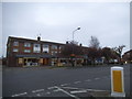
Area Overview for Frinton Ward
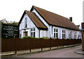
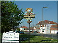
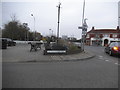
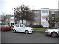
Photos of Frinton Ward


Area Information
Frinton Ward sits on the Essex coast as an electoral division within the Tendring District Council. It forms part of the civil parish of Frinton and Walton, located roughly 4¼ miles south-west of the Naze headland at coordinates 51.83°N, 1.25°E. The town centre holds a built-up population of 4,951 according to the 2021 census, creating an intimate coastal community despite its modern transport links. Daily life here revolves around a sandy and stone beach exceeding one mile in length, which is washed every day and lined with several hundred beach huts. A long greensward stretches inland from the promenade, offering a shared space for residents and visitors between the Walton-on-Naze boundary and the golf club to the south. The area maintains a distinct character shaped by early industrialist Richard Powell Cooper, who rejected plans for a pier and prohibited boarding houses and pubs during its development in the 1890s. These historical decisions have left a legacy of residential quiet alongside high-quality housing. You will find the Sea Defence Act 1903 project stabilising the cliffs with the Greensward, ensuring the coastline remains secure for future generations. The ward offers clear geographical separation historically maintained by controlled access points via road and railway, fostering a sense of locality. Families and retirees alike enjoy the designated swimming, sailing, and windsurfing zone while benefiting from the town's established infrastructure. Living in Frinton Ward means accessing a seaside setting where the past continues to influence the present environment. The combination of regulated growth and natural beauty defines the experience for anyone moving to homes in this district.
- Area Type
- District Borough Unitary Ward
- Area Size
- 2.9 km²
- Population
- Not available
- Population Density
- Not available
Demographics
The community within Frinton Ward displays a distinctly mature profile compared to the national average. The median age stands at exactly 70 years, indicating that the population is significantly older than most other areas. This demographic skew reflects a neighbourhood largely inhabited by retirees or those nearing retirement age. Despite this age profile, the area maintains high levels of independence through local services and amenities. Home ownership drives the social structure of this ward, with 79% of dwellings occupied by their owners. This high ownership rate suggests long-term residents who have put down roots and cared for their houses over many years. The area benefits from a stable social environment where neighbours know one another, likely due to the elderly population and low rental turnover. While specific data on household composition breakdowns by type remains undetailed, the overall picture points toward single-occupancy households or couples without dependent children. The accommodation types reflect this stability, with permanent residences outweighing seasonal or holiday lets. Cultural diversity metrics for the predominant ethnic group and religion are recorded as totals, confirming a generally homogenous population characteristic of many traditional seaside towns in Essex. You should expect a friendly, older demographic where the pace of life is slower than in urban centres. This demographic makeup influences the local economy and service demand, with a focus on healthcare and leisure rather than child-centric facilities. The safety score of 80 out of 100 further supports the appeal of a quiet, predictable community. Low crime rates align with the settled nature of the residents. When you consider living in Frinton Ward, you are choosing an environment defined by age, ownership, and tranquillity. The statistics confirm that this is not a rapidly shifting marketplace but a established home for a specific generation of Essex residents.
Household Size
Accommodation Type
Tenure
Ethnic Group
Religion
Household Composition
Age
Household Deprivation
NS-SEC
Explore more demographic insights in this area
Go to Demographics tabPlanning
Planning Constraints
- Flood RiskLocked
- Ramsar Wetland SitesLocked
- Area of Outstanding Natural BeautyLocked
- Protected Nature ReserveLocked
- Protected WoodlandLocked
- Crime RiskLocked