Area Overview for Friar's Wash
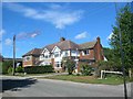
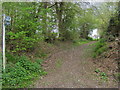
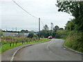
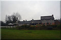
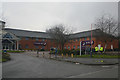
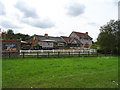
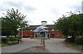
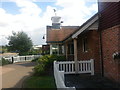
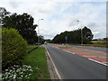
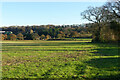
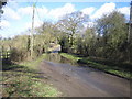
Photos of Friar's Wash

Area Information
Friar’s Wash is a compact built-up area spanning 29.3 hectares, situated in England. Its small size creates a tight-knit community feel, where daily life is shaped by proximity to essential services and transport links. The area’s median age of 70 suggests a population skewed towards older residents, which influences the local character and pace of life. Homeownership is high, with 88% of properties owner-occupied, indicating a stable, long-term resident base. Living here means easy access to nearby amenities: five retail outlets, including Spar M6 and Tesco Harpenden, and rail connections to Harpenden, Luton, and Luton Airport Parkway. Proximity to London Luton Airport adds convenience for frequent travellers. While the area’s size is modest, its strategic location near major transport routes and retail hubs makes it practical for those prioritising accessibility over sprawling landscapes. For buyers, Friar’s Wash offers a blend of affordability, convenience, and a quieter lifestyle, though the demographic profile may appeal more to those seeking a settled, mature community.
- Area Type
- Built Up Area 250
- Area Size
- 29.3 hectares
- Population
- Not available
- Population Density
- Not available
Living in Friar’s Wash offers access to a range of practical amenities within walking or short driving distance. Retail options include Spar M6, Co-op Redbourn, and Tesco Harpenden, providing essentials for daily life. The area’s rail links to Harpenden, Luton, and Luton Airport Parkway ensure easy access to urban centres and regional hubs. Proximity to London Luton Airport adds convenience for travel, while the compact size of the area means amenities are never far. The presence of multiple retail outlets and transport options fosters a self-sufficient lifestyle, reducing the need for long commutes. Though the area lacks large parks or leisure facilities, its focus on accessibility and connectivity makes it ideal for those prioritising convenience over expansive recreational spaces. The mix of shops, transport, and travel infrastructure creates a functional, practical environment tailored to everyday needs.
Amenities
Schools
| Rank | School | Type | Entry gender | Ages |
|---|
Explore more schools in this area
Go to Schools tabDemographics
The population of Friar’s Wash has a median age of 70, reflecting a community predominantly composed of older adults. This age profile shapes the area’s dynamics, with household types and accommodation preferences likely aligned with the needs of this demographic. Homeownership is exceptionally high at 88%, suggesting a lack of rental properties and a focus on long-term residency. The data does not specify household composition or ethnic diversity, but the overall figures indicate a stable, less transient population. The area’s small size and high ownership rate may contribute to a cohesive, familiar social environment. However, the absence of detailed breakdowns on age ranges or ethnic groups means the full picture of diversity remains unclear. For prospective buyers, the demographic profile suggests a community prioritising security, continuity, and established living arrangements over rapidly changing urban environments.
Household Size
Accommodation Type
Tenure
Ethnic Group
Religion
Household Composition
Age
Household Deprivation
NS-SEC
Explore more demographic insights in this area
Go to Demographics tabPlanning
Planning Constraints
- Crime RiskPremium