Area Overview for Frettenham
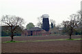
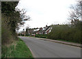
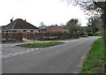
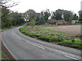
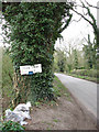
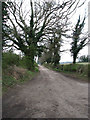
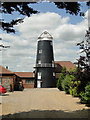
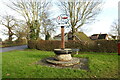
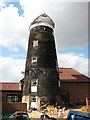
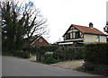
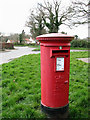
Photos of Frettenham

Area Information
Frettenham is a compact built-up area in England, covering 27.1 hectares. Its small size means it is likely a focused, tightly knit community, with a population skewed toward older residents, as the median age is 70. This suggests a demographic where retirees or long-term residents form the majority. The area’s proximity to Norwich International Airport and several railway stations, including Norwich and Salhouse, positions it as a practical choice for commuters or those needing regular travel. Daily life in Frettenham balances local amenities with access to regional infrastructure. While the area lacks large-scale developments, its modest size and established infrastructure create a quiet, stable environment. For those seeking a place with a low crime risk and strong broadband connectivity, Frettenham offers a blend of practicality and safety. The presence of Frettenham Primary School, rated ‘good’ by Ofsted, adds to its appeal for families, though secondary education options may require travel. Living here means embracing a slower pace, with a focus on local shops, transport links, and a community that prioritises home ownership.
- Area Type
- Built Up Area 250
- Area Size
- 27.1 hectares
- Population
- Not available
- Population Density
- Not available
Frettenham’s lifestyle is shaped by its proximity to essential amenities. Local retail options include Morrisons Old, Lidl Sprowston, and East of England Co-operative Co, providing everyday shopping needs. The area’s rail stations, such as Salhouse and Norwich, offer easy access to urban centres, while Norwich International Airport caters to those needing regional or international travel. Though the data does not mention parks or leisure facilities, the presence of multiple retail and transport hubs suggests a practical, convenience-driven lifestyle. Residents can enjoy a mix of local shopping, efficient commuting, and travel opportunities. The compact nature of the area means amenities are likely within walking or short driving distance, supporting a low-maintenance daily routine. For those valuing accessibility over expansive recreational spaces, Frettenham’s amenities align with a focused, functional approach to living.
Amenities
Schools
Frettenham Primary School is the only named school within the area, offering primary education with a ‘good’ Ofsted rating. This suggests a reliable foundation for younger children’s education, though the absence of secondary schools in the data means families may need to look beyond Frettenham for secondary education. The single primary school may indicate a smaller student population, which could mean smaller class sizes or a more personalised learning environment. For families prioritising strong primary education, Frettenham’s school is a positive feature, but those requiring comprehensive schooling from early years to secondary may need to plan for additional travel. The school’s rating reflects a satisfactory standard, aligning with the area’s overall practical approach to infrastructure.
| Rank | A + A* % | School | Type | Entry gender | Ages |
|---|---|---|---|---|---|
| 1 | N/A | Frettenham Primary School | primary | N/A | N/A |
Explore more schools in this area
Go to Schools tabDemographics
Frettenham’s population has a median age of 70, indicating a community predominantly composed of older adults. The most common age range is listed as ‘Age: Total,’ which may reflect aggregated data but underscores the area’s maturity. Home ownership is high, with 83% of residents owning their homes, suggesting a stable, long-term population. This figure implies limited rental availability, which could influence the local housing market. The data does not specify household composition or accommodation types, but the high home ownership rate points to a community where property is viewed as a long-term investment. The absence of detailed diversity metrics means the area’s cultural or ethnic composition remains unspecified, though the ‘total’ designation for predominant ethnic group and religion suggests broad inclusivity. For quality of life, the low crime risk and practical transport links may be particularly appealing to older residents or those seeking a secure, established environment.
Household Size
Accommodation Type
Tenure
Ethnic Group
Religion
Household Composition
Age
Household Deprivation
NS-SEC
Explore more demographic insights in this area
Go to Demographics tabPlanning
Planning Constraints
- Crime RiskLocked