Area Overview for Freethorpe
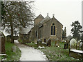
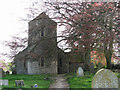
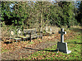
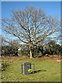
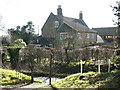
Photos of Freethorpe

Area Information
Freethorpe is a compact built-up area spanning 39 hectares in England, characterised by its older demographic and strong sense of local identity. With a median age of 70, the community reflects a population that values stability and proximity to essential services. The area’s size is modest but sufficient to support a range of daily needs, including nearby schools, transport links, and retail options. Freethorpe is not a sprawling suburb but a focused neighbourhood where residents can access amenities within walking or short driving distance. Its appeal lies in its practicality—home ownership is high at 76%, suggesting a long-term commitment to the area. While the population profile is distinct, the presence of a primary school with a good Ofsted rating and multiple rail stations indicates that Freethorpe balances residential comfort with connectivity. For those seeking a quieter, well-served community with a clear sense of place, Freethorpe offers a straightforward alternative to larger urban centres. The area’s character is defined by its accessibility and the interplay between local infrastructure and the surrounding landscape.
- Area Type
- Built Up Area 250
- Area Size
- 39.0 hectares
- Population
- Not available
- Population Density
- Not available
Freethorpe’s residents benefit from a range of nearby amenities that support daily life. The five rail stations, including Reedham and Acle, provide easy access to commuting routes, while the Reedham Ferry North offers a unique transport option for those needing to cross waterways. Retail options are well-served by the East of England Co-operative Co, M&S Acle BP, and Spar, ensuring that groceries, fuel, and other essentials are within reach. Though the area lacks large-scale leisure facilities, the presence of multiple rail stations and a ferry suggests that residents can easily access larger towns for dining, entertainment, or cultural activities. The compact nature of Freethorpe means that amenities are concentrated, reducing the need for long commutes. This balance between local convenience and regional connectivity makes the area practical for those prioritising accessibility over expansive leisure options.
Amenities
Schools
Freethorpe Community Primary and Nursery School is the only school explicitly listed in the data, serving the area’s younger residents. As a primary school with a good Ofsted rating, it provides a reliable educational foundation for local children. The absence of secondary schools or further education institutions in the immediate vicinity means families may need to look beyond Freethorpe for comprehensive schooling options. However, the presence of a well-rated primary school suggests that the area is functional for families with young children, though it may not cater to older students without additional travel. The school’s rating indicates a satisfactory standard of education, which is a key consideration for prospective buyers prioritising proximity to quality schools. For those requiring secondary education, the nearby rail stations could facilitate commuting to larger towns or cities with more extensive educational facilities.
| Rank | School | Type | Entry gender | Ages |
|---|
Explore more schools in this area
Go to Schools tabDemographics
Freethorpe’s population has a median age of 70, which is notably higher than the national average, suggesting a community skewed towards older adults. This demographic profile influences the area’s dynamics, with household composition and accommodation types reflecting long-term residency patterns. Home ownership is strong, with 76% of residents owning their homes—a figure that underscores a stable, settled population. While specific data on ethnic diversity or religious composition is not provided, the area’s demographic makeup is likely to be homogeneous given the age and ownership statistics. The absence of detailed breakdowns on household types or deprivation levels means that broader quality-of-life implications remain unquantified. However, the high home ownership rate suggests a community prioritising security and continuity. For buyers, this profile indicates a market where properties are likely to be held long-term, with fewer speculative or short-term investments influencing the local housing stock.
Household Size
Accommodation Type
Tenure
Ethnic Group
Religion
Household Composition
Age
Household Deprivation
NS-SEC
Explore more demographic insights in this area
Go to Demographics tabPlanning
Planning Constraints
- Crime RiskPremium