Area Overview for Framsden
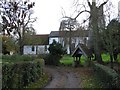
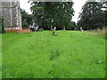
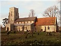
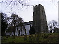
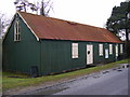
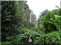
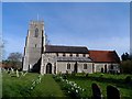
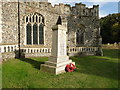
Photos of Framsden
Area Information
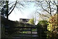
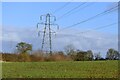
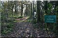
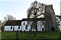
Living in Framsden offers a distinct rural experience defined by its compact civil parish footprint of 11.6 km². This small locality provides a settled environment where daily life moves at a measured pace, appealing to those seeking peace away from urban congestion. The area's size ensures that residents have immediate access to local amenities while maintaining a strong connection to the surrounding countryside. You will find a community where neighbours know one another, creating a supportive social fabric typical of this part of England. The landscape is open and spacious, free from significant planning constraints that might limit future development or dilute the character of the village. For anyone considering homes in Framsden, the parish represents a straightforward choice for rural living without the complications of protected sites or flood risks. The environment is safe, with low crime rates, and the lack of major flooding concerns ensures peace of mind for homeowners. You do not need to worry about living in an area with designated nature reserves or woodlands that could restrict building projects. Instead, the focus remains on a peaceful, functional home. The simplicity of the location means you avoid hefty conveyancing costs associated with complex environmental restrictions. This makes Framsden an accessible and practical option for individuals or families who prioritise stability and a quiet lifestyle in a manageable geographical space.
- Area Type
- Parish
- Area Size
- 11.6 km²
- Population
- Not available
- Population Density
- Not available
Demographics
The community in Framsden is characterised by an older population, reflecting a traditional, established village existence. The median age here stands at 70 years, indicating that this parish is predominantly inhabited by retirees and older adults. This age profile suggests a neighbourhood where life moves slowly and community activities often centre on long-term residents passing on knowledge and friendship. With a household composition made up of 'total' households, which allows for a varied range of living arrangements suitable for seniors, the area caters well to those emptying their nests or retiring. Home ownership levels are exceptionally high at 76%, showing that the majority of residents have bought their homes rather than renting. This statistic underscores the permanence of the population and the equity-rich nature of the community. You are likely to meet long-term residents who have built their lives in Framsden over many decades. There is no indication of high deprivation or youth unemployment that could typify areas with large student populations or young families struggling in a competitive market. Instead, the demographic picture presents a stable, older demographic who are content with their surroundings. The lack of specific data on ethnic diversity or religious breakdown does not diminish the clarity of the age and ownership picture. You can expect a homogenous society defined by its senior residents and their strong attachment to property.
Household Size
Accommodation Type
Tenure
Ethnic Group
Religion
Household Composition
Age
Household Deprivation
NS-SEC
Explore more demographic insights in this area
Go to Demographics tabPlanning
Planning Constraints
- Flood RiskPremium
- Ramsar Wetland SitesPremium
- Area of Outstanding Natural BeautyPremium
- Protected Nature ReservePremium
- Protected WoodlandPremium
- Crime RiskPremium