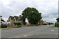
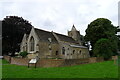
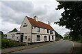
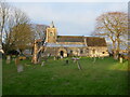
Area Overview for Farcet
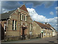
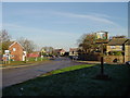
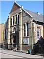
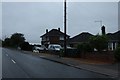
Photos of Farcet

Area Information
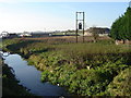
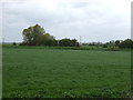
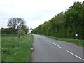
Farcet is a compact built-up area in England, covering 45.1 hectares. It is home to a population with a median age of 70, suggesting a community skewed toward older residents. The area’s size is modest, which may contribute to a close-knit feel, though it remains connected to nearby towns and services. Living in Farcet means proximity to essential amenities, including retail outlets, transport hubs, and a primary school with a good Ofsted rating. The area’s broadband score of 100 ensures reliable internet connectivity, supporting both daily use and remote work. While Farcet itself is small, its strategic location near Peterborough and other nearby towns offers access to broader opportunities. The mix of home ownership (68%) and rental properties indicates a blend of long-term residents and those seeking more flexible housing. For buyers, Farcet presents a chance to own property in a low-crime area with practical connectivity, though its demographic profile suggests it may appeal more to retirees or those prioritising safety and stability over a younger, dynamic community.
- Area Type
- Built Up Area 250
- Area Size
- 45.1 hectares
- Population
- Not available
- Population Density
- Not available
Farcet’s residents have access to a range of amenities within practical reach. The area is surrounded by five retail outlets, including Morrisons Stanground, Tesco Stanground, and Co-op Peterborough, providing convenient shopping options. Nearby metro areas like Peterborough, Orton Mere, and Ferry Meadows offer additional leisure and dining opportunities. For transport, two rail stations—Peterborough and Whittlesea—connect to broader networks, while Peterborough Business Airport serves those needing air travel. The proximity to these facilities suggests a lifestyle that balances local convenience with access to larger urban centres. The presence of retail and transport hubs supports both daily errands and occasional travel, though the small size of Farcet itself means the character of the area is likely defined by its immediate surroundings rather than large-scale developments. This setup may appeal to those seeking a quiet base with easy access to more dynamic environments.
Amenities
Schools
The nearest school to Farcet is Farcet CofE (C) Primary School, which serves the local community with a primary education offering. The school holds a good Ofsted rating, reflecting its quality of teaching and facilities. As a primary school, it caters to younger children, making it a critical consideration for families with young dependents. The absence of secondary schools in the immediate vicinity means students may need to travel to nearby towns such as Peterborough for further education. The presence of a well-rated primary school is a positive factor for families prioritising educational standards, though the lack of higher-tier schools could be a limitation for those seeking a comprehensive local education system. This mix of school types underscores the need for careful planning when considering Farcet as a family-friendly area.
| Rank | School | Type | Entry gender | Ages |
|---|
Explore more schools in this area
Go to Schools tabDemographics
The population of Farcet has a median age of 70, the highest age group recorded, indicating a community predominantly composed of older adults. Home ownership stands at 68%, suggesting a significant portion of residents are long-term homeowners, though the exact breakdown of rental properties is not specified. The data does not provide detailed information on household composition, accommodation types, or ethnic diversity, so these aspects remain unclear. The absence of specific figures on deprivation or socioeconomic status means it is difficult to assess how these factors might influence quality of life. However, the high median age may imply a population with established routines and limited demand for family-oriented amenities. For prospective buyers, this demographic profile could suggest a market skewed toward retirees or those seeking low-maintenance living, though further data would be needed to confirm this trend.
Household Size
Accommodation Type
Tenure
Ethnic Group
Religion
Household Composition
Age
Household Deprivation
NS-SEC
Explore more demographic insights in this area
Go to Demographics tabPlanning
Planning Constraints
- Crime RiskPremium