Area Overview for Eynesford Ward
Photos of Eynesford Ward
Area Information
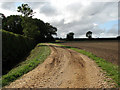
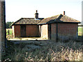
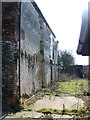
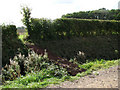
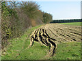
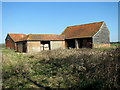
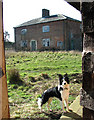
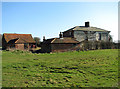
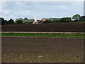
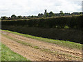
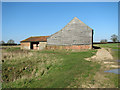
Living in Eynesford Ward offers a distinctive blend of rural tranquillity and established access to major transport networks. This village and civil parish sits within the Sevenoaks District, covering an area of 65.8 km² across the Darent Valley. You find yourself approximately 3.3 miles south-east of Swanley, just 7 miles south of Dartford, and 6.5 miles north of Sevenoaks. Despite being 18 miles south-east of central London, the locale retains a peaceful, cosy atmosphere typical of the Kent Downs Area of Outstanding Natural Beauty. Your daily life is shaped by the undulating landscape, which features farmland and woodland bounded by the M20 and M25 motorways. The village history is deeply rooted in its name, derived from Old English meaning 'Ægen's Ford', indicating early development around the River Darent crossing. A conservation area was designated in 1973 and extended in 2006, protecting the linear High Street where houses and trades coalesced over centuries. You can explore notable features such as Eynsford Castle, the medieval parish church, and the picturesque River Darent meadows. Rail transport connects the ward to Sevenoaks and London via a railway opened in 1862. This infrastructure, marked by an impressive viaduct within the conservation area, ensures you remain integrated with wider urban opportunities while enjoying the sense of rural detachment that defines life near the North Downs. The area remains popular for those seeking homes in Eynesford Ward who value historic character alongside modern logistical convenience.
- Area Type
- District Borough Unitary Ward
- Area Size
- 65.8 km²
- Population
- Not available
- Population Density
- Not available
Demographics
The community profile of Eynesford Ward is defined by a notably older population. The median age in this ward stands at 70 years, indicating a demographic heavily skewed towards the elderly. This high median age suggests a community where retirees and long-term residents dominate the social fabric rather than young families or working-age professionals. Consequently, everyday interactions likely centre around leisure, health, and established social networks typical of such an age profile. Home ownership remains the primary mode of accommodation, with 67 per cent of residents owning their property outright or with a mortgage. This high figure reinforces the stability of the neighbourhood, as owner-occupiers often contribute to lower turnover rates and community cohesion. The data indicates that most households are likely composed of individuals or couples rather than large families, aligning with the advanced age statistics. While specific breakdowns for ethnic groups and religious affiliation are not detailed in the current data, the extension of the conservation area in 2006 highlights the ward's commitment to preserving its unique character. The presence of Eynsford Castle and the medieval parish church further anchors the local identity in history. For those considering homes in Eynesford Ward, the demographic reality means you should expect a quiet, settled environment where the pace of life reflects the needs of an older community.
Household Size
Accommodation Type
Tenure
Ethnic Group
Religion
Household Composition
Age
Household Deprivation
NS-SEC
Explore more demographic insights in this area
Go to Demographics tabPlanning
Planning Constraints
- Flood RiskPremium
- Ramsar Wetland SitesPremium
- Area of Outstanding Natural BeautyPremium
- Protected Nature ReservePremium
- Protected WoodlandPremium
- Crime RiskPremium