Area Overview for Etton
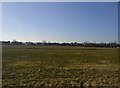
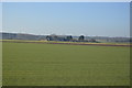
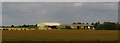
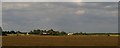
Photos of Etton


Area Information
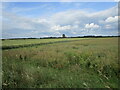
Etton is a civil parish situated in England covering an area of 5.3 km². This relatively compact location offers a distinct residential environment where the landscape and community are tightly knit. You are looking at a place where the physical footprint is small, which often fosters a strong sense of locality among those who call it home. The village character defines daily life here, separate from the larger urban centres that dominate the national landscape. Living in Etton provides a setting where you experience the benefits of a tangible place rather than a sprawling estate. The population demographics suggest a settlement with specific historical roots, evident in the community's composition. You will find that the area is not designed for high-density living but rather for those who value a defined neighbourhood boundary. The small size means that distances between homes, shops, and local greenspaces are immediately apparent without the need for extensive travel planning. Your experience of Etton will be shaped by its status as a defined parish within the broader English countryside. This concentration allows for a managed community atmosphere rather than an anonymous urban sprawl. You can expect a lifestyle where the local environment plays a central role in your routine. The area functions as a standalone community with its own identity, separate from nearby towns or cities. This independence gives residents a clear sense of ownership over their immediate surroundings. When you consider your future in Etton, you are choosing a location with a precise geographic identity. The 5.3 km² figure tells you what you actually have to work with, not a speculative expansion. This clarity helps you understand the limits and the strengths of the parish immediately. Living here means accepting and enjoying the scale of the community as it exists today.
- Area Type
- Parish
- Area Size
- 5.3 km²
- Population
- Not available
- Population Density
- Not available
Demographics
The community in Etton has a clear demographic profile defined by specific age and ownership Data. The median age stands at 70 years, which places this settlement firmly within the senior demographic bracket. You will find that the most common age range aligns with this high median, indicating a resident base that has largely grown older than the national average. This profile reflects a community where families with young children are less prevalent than those in later life stages. Home ownership rates show a significant level of stability with 85% of residents owning their property. This statistic confirms that Etton is predominantly an owner-occupied area rather than a rental market. You are likely to encounter neighbours who have established long-term roots in the parish, contributing to a steady social fabric. The high ownership rate suggests that residents have invested significantly in their local environment over many years. Accommodation diversity within the parish aligns with this predominance of ownership. The data indicates a household composition typical of a settled, aging population. You will not see the transient nature found in student villages or commuter hotspots. Instead, the social structure reflects a community where people have stayed put for extended periods. This consistency creates a predictable environment where relationships between neighbours are well-established. The ethnic and religious data reflects the total population composition without isolated pockets of divergence. Your daily interactions will occur within a community that mirrors the broader demographic in terms of established groupings. The age factor influences local services and community activities, ensuring they cater to an older populace. Living in Etton means engaging with a cohort of residents who share a similar life stage and likely similar priorities regarding their local space.
Household Size
Accommodation Type
Tenure
Ethnic Group
Religion
Household Composition
Age
Household Deprivation
NS-SEC
Explore more demographic insights in this area
Go to Demographics tabPlanning
Planning Constraints
- Flood RiskPremium
- Ramsar Wetland SitesPremium
- Area of Outstanding Natural BeautyPremium
- Protected Nature ReservePremium
- Protected WoodlandPremium
- Crime RiskPremium