Area Overview for Essendon
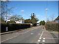
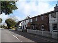
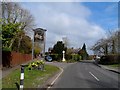
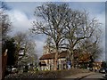
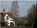
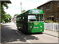
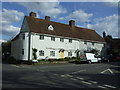
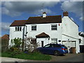
Photos of Essendon


Area Information
Essendon is a compact built-up area spanning 36.1 hectares in England, characterised by its mature population and established infrastructure. With a median age of 70, the area is home to a predominantly older demographic, suggesting a community with a long-standing presence. Daily life here is shaped by proximity to essential services, including five retail outlets such as Morrisons Daily Welwyn and Co-op Ludwick, and five railway stations, including Bayford and Hatfield, which provide reliable connections to nearby towns. The area’s small size means residents can access amenities within practical reach, fostering a sense of convenience. While the data does not specify the proportion of owner-occupied versus rental properties, the 63% home ownership rate indicates a mix of long-term residents and those seeking stable housing. Essendon’s appeal lies in its balance of accessibility, with good broadband and mobile connectivity, and a modest crime risk that aligns with average national rates. For those prioritising ease of access to transport and local services, Essendon offers a straightforward, no-frills lifestyle.
- Area Type
- Built Up Area 250
- Area Size
- 36.1 hectares
- Population
- Not available
- Population Density
- Not available
Essendon’s lifestyle is shaped by its proximity to essential amenities, including five retail outlets such as Morrisons Daily Welwyn, Co-op Ludwick, and Budgens Hatfield. These stores provide access to groceries, household goods, and convenience services, reducing the need for long trips to larger centres. The area’s five railway stations, including Hatfield and Welham Green, offer easy access to nearby towns, enhancing mobility for both daily commutes and weekend excursions. While the data does not specify parks or leisure facilities, the availability of retail and transport options suggests a practical, no-frills lifestyle. Residents can enjoy a mix of local shopping and efficient travel, though the absence of details on green spaces or cultural venues means the area’s recreational offerings remain undefined.
Amenities
Schools
The only school explicitly listed near Essendon is Essendon CofE (VC) Primary School, which is rated “good” by Ofsted. This institution serves the primary education needs of the area, though no secondary schools are mentioned in the data. The presence of a single primary school suggests that families with young children may need to travel to nearby towns for secondary education. The “good” Ofsted rating indicates the school meets acceptable standards, but without additional details on its curriculum or performance metrics, it is difficult to gauge its broader appeal. For parents prioritising proximity to schools, Essendon offers a basic foundation, but further research would be needed to evaluate the full range of educational options available.
| Rank | School | Type | Entry gender | Ages |
|---|
Explore more schools in this area
Go to Schools tabDemographics
The population of Essendon has a median age of 70, indicating a community skewed towards older adults. The most common age range is listed as “Age: Total,” which likely reflects aggregated data rather than specific cohorts. Home ownership stands at 63%, suggesting a majority of residents live in properties they own, though the exact breakdown of household types and accommodation categories is not specified. The predominant ethnic group and religious affiliation are also reported as “total,” meaning no granular data is available on diversity. This lack of detail means the area’s social composition remains opaque. However, the median age implies a population with potentially higher healthcare needs and lower demand for amenities catering to younger families. The absence of specific figures on deprivation or income levels means quality-of-life factors beyond age and ownership remain unexplored.
Household Size
Accommodation Type
Tenure
Ethnic Group
Religion
Household Composition
Age
Household Deprivation
NS-SEC
Explore more demographic insights in this area
Go to Demographics tabPlanning
Planning Constraints
- Crime RiskPremium