Area Overview for Erpingham
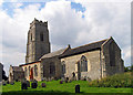
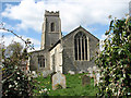
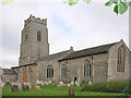
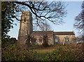
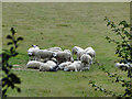
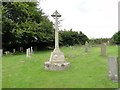
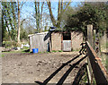
Photos of Erpingham


Area Information
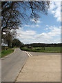
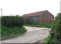
Erpingham is a compact built-up area in England, spanning 24.4 hectares and characterised by its older demographic profile. With a median age of 70, the community here is predominantly composed of long-term residents, many of whom may have lived in the area for decades. The area’s safety is a notable feature, with a crime risk score of 89—well below average, reflecting a secure environment for residents. Daily life in Erpingham is shaped by its proximity to nearby towns like Aylsham and Norwich, offering access to essential amenities. Residents can walk or cycle to local shops such as Co-op Aylsham and Tesco Norwich, while rail links to Gunton, North Walsham, and Roughton Road stations provide convenient connections to larger urban centres. The area’s small size means it retains a quiet, low-key character, though it is not isolated. For those seeking a peaceful yet connected lifestyle, Erpingham balances accessibility with a sense of seclusion, making it a viable option for those prioritising safety and simplicity.
- Area Type
- Built Up Area 250
- Area Size
- 24.4 hectares
- Population
- Not available
- Population Density
- Not available
Residents of Erpingham have access to a range of nearby amenities that support daily life. Within practical reach are five retail outlets, including Co-op Aylsham and Tesco Norwich, providing essential shopping options. The area’s rail network is well-served by three stations—Gunton, North Walsham, and Roughton Road—offering regular connections to larger towns and cities. These stations not only facilitate commuting but also allow residents to access cultural, professional, and recreational opportunities beyond Erpingham. While the area itself is small, its proximity to Aylsham and the broader Norfolk region means residents can enjoy a blend of local convenience and regional access. The presence of multiple retail points and transport links suggests a community that values practicality, though the lack of detailed data on parks or leisure facilities means the area’s recreational offerings remain unspecified.
Amenities
Schools
| Rank | A + A* % | School | Type | Entry gender | Ages |
|---|
Explore more schools in this area
Go to Schools tabDemographics
The population of Erpingham is defined by its median age of 70, indicating a community skewed towards older adults. This age profile suggests a demographic that may prioritise stability and established infrastructure over rapid change. Home ownership is high, with 75% of properties owner-occupied, pointing to a settled population less likely to move frequently. The data does not specify household composition or accommodation types, but the overall figures imply a mix of family homes and single-occupancy properties. The lack of detailed diversity metrics means the area’s ethnic or cultural composition remains unspecified, though the provided data notes no significant disparities in these categories. For residents, this demographic structure may translate to a community with shared generational experiences and a focus on long-term residency. The absence of specific deprivation data means it is unclear whether the area faces socioeconomic challenges, but the high home ownership rate and low crime risk suggest a relatively stable environment.
Household Size
Accommodation Type
Tenure
Ethnic Group
Religion
Household Composition
Age
Household Deprivation
NS-SEC
Explore more demographic insights in this area
Go to Demographics tabPlanning
Planning Constraints
- Crime RiskLocked