Area Overview for Epping West & Rural Ward
Photos of Epping West & Rural Ward
Area Information
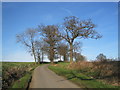
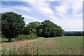
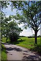
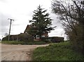
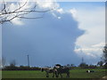
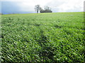
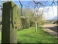
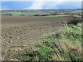
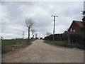
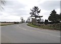
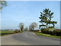
Epping West & Rural Ward stands as a distinct electoral ward within Epping Forest District Council, situated in the East of England region. This area covers 27.9 km² and operates as part of the broader Epping Forest UK Parliament constituency. Its location places it around coordinates 51.7188°N, 0.0790°E, specifically within the west and rural fringes of Epping town. You will find this ward sits deeply within the Metropolitan Green Belt, bordered by the ancient Epping Forest woodland. The combination of designated rural designation and proximity to one of London's most famous woods defines the physical character of Epping West & Rural Ward. Daily life here reflects a specific balance between country living and connection to the wider district. The ward's identity is rooted in its administrative status as a district borough unitary ward, ensuring local governance aligns with broader county planning. Residents navigate an environment where urban services meet natural constraints. When considering homes in Epping West & Rural Ward, you are entering a specific geographic sphere where town boundaries blur into forest edges. This locality offers a setting where the rural designation is a legal and physical reality, not just a description. The area provides a stable backdrop for families and retirees who value the specific boundaries set by the Green Belt and ancient woodland.
- Area Type
- District Borough Unitary Ward
- Area Size
- 27.9 km²
- Population
- Not available
- Population Density
- Not available
Demographics
The community profile in Epping West & Rural Ward reveals a settled, established population. The median age is 70, indicating that older residents form the core of the demographic landscape. Data shows the total age profile is the most common range, confirming that this ward is not a transient area. Home ownership is extremely high at 73%, suggesting that financial independence is widespread among residents. This high rate of ownership points to a community where families and couples have settled permanently rather than renting short-term. While specific data on household composition totals are available, the overall picture suggests a stable living arrangement. There are no young professionals or students dominating the scene, which explains the elevated median age. Accommodation types reflect the long-term nature of occupancy, with the majority of dwellings held by owners. The absence of significant rental markets means that people move here with the intention of staying. Diversity metrics show the total ethnic group breakdown but do not indicate dominant minority populations in this specific data set. Religious affiliation data is similarly presented as a total figure without specific denominational breakdown. The demographic reality of Epping West & Rural Ward is one of quiet stability where residents prioritize permanence over transient living.
Household Size
Accommodation Type
Tenure
Ethnic Group
Religion
Household Composition
Age
Household Deprivation
NS-SEC
Explore more demographic insights in this area
Go to Demographics tabPlanning
Planning Constraints
- Flood RiskPremium
- Ramsar Wetland SitesPremium
- Area of Outstanding Natural BeautyPremium
- Protected Nature ReservePremium
- Protected WoodlandPremium
- Crime RiskPremium