Area Overview for Epping East Ward
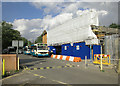
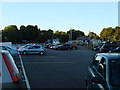
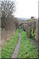
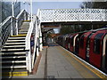
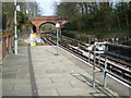
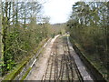
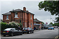
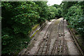
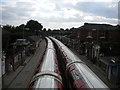
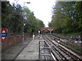
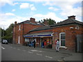
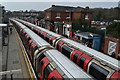
Photos of Epping East Ward
Area Information
Living in Epping East Ward offers a defined character within the wider borough, covering a precise total area of 5.3 square kilometres. You will find this district borough unitary ward established as a distinct locality with clear boundaries. The space is compact enough to feel intimate yet structured within the local administrative framework. Your daily life here unfolds in a setting that prioritises stability and continuity. The environment supports residents who value a neighbourhood with established roots and a history of settlement. You can expect a pace of life that balances community interaction with private space. The physical layout of the ward provides a manageable scale for exploring local amenities and accessing key services. This area represents a settled part of the region where long-term living arrangements are common. Your routine activities, from morning walks to evening commutes, take place within a well-defined geographical zone. The ward functioned under the unitary authority system, providing a consistent governance structure for the community. You are situated in an area where the neighbourhood identity remains strong and locally recognised. Every aspect of your day benefits from the clear spatial organisation of this 5.3 kilometre stretch. This area continues to serve as a functional and recognised unit for those choosing to call Epping East Ward their home.
- Area Type
- District Borough Unitary Ward
- Area Size
- 5.3 km²
- Population
- Not available
- Population Density
- Not available
Demographics
The community in Epping East Ward reflects a mature demographic profile with significant implications for daily life. The median age for residents stands at 70, indicating that the population is heavily weighted towards older households. Most of the people living here fall into wider age categories that correspond with this high median figure. Home ownership reaches 67%, which is notably high compared to national averages for similar districts. This statistic reveals that the ward consists predominantly of owner-occupiers rather than renters or shared-ownership schemes. The household composition data covers the total population, showing how families and individuals occupy the available dwellings. Accommodation types across the total footprint of the ward reflect the preferences of this affluent, older demographic. You will find that the majority of homes are single-family properties or large flats suited to established residents. Diversity metrics cover the total ethnic group distribution, providing a picture of the community's background. Religious affiliation statistics also reflect the total population, showing established patterns of belief within the ward. The high age profile means you will encounter fewer young families and more pensioners on your doorsteps. This demographic reality shapes local demand, influencing everything from shop offerings to school enrolment in nearby districts. Your neighbourly relationships are likely forged among a group that shares similar life stages and values. The 67% ownership rate suggests stability, with many residents having lived in their properties for decades. You live in an environment where generational change happens slower than in areas with younger populations.
Household Size
Accommodation Type
Tenure
Ethnic Group
Religion
Household Composition
Age
Household Deprivation
NS-SEC
Explore more demographic insights in this area
Go to Demographics tabPlanning
Planning Constraints
- Flood RiskPremium
- Ramsar Wetland SitesPremium
- Area of Outstanding Natural BeautyPremium
- Protected Nature ReservePremium
- Protected WoodlandPremium
- Crime RiskPremium