Area Overview for Epping
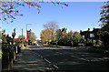
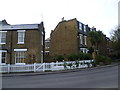
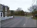
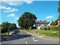
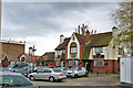
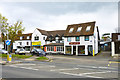
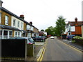
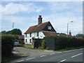
Photos of Epping


Area Information
Epping is a compact built-up area covering just 2.8 km² in England. This small footprint defines daily life for residents who require quick access to surroundings without long commutes across vast distances. The area functions as a distinct town within the broader borough, offering a dense concentration of homes and local services. Population density is higher than in surrounding suburban zones due to this limited land area. Living in Epping means navigating a tightly packed community where neighbours are often close by. The town centre anchors the local identity, supported by a network of transport links that connect directly to wider regions. You will find that facilities are walkable, reducing the need for private vehicles for short journeys. Infrastructure is mature, catering to a population that values convenience and established local institutions. The scale of the area ensures that amenities are never far away, creating a self-contained environment for families. This concentration supports a strong sense of locality, where community events and local shops serve as the focal point of social interaction. The physical boundaries ensure that the noise and traffic from the wider city do not overwhelm the town centre experience. A home here provides immediate access to the trains and tube stations that define commuter lifestyles. The compact nature of the area means you can explore significant portions of Epping on foot within minutes. This accessibility makes it appealing for those who prioritise walkability. The environment balances urban convenience with the relative calm of a smaller town. You will appreciate how the limited size allows for a cohesive community structure. Daily routines revolve around close-knit neighbourhoods and reliable transport connections.
- Area Type
- Built Up Area 250
- Area Size
- 2.8 km²
- Population
- Not available
- Population Density
- Not available
Living in Epping grants you immediate access to a range of retail and leisure venues. Five major retailers are within practical reach, including Tesco Epping, M&S Epping SF, and Morrisons Daily Epping 273. These supermarkets shape daily grocery shopping habits for residents. The retail category also includes smaller local shops that contribute to the town centre character. Transport links are extensive, with five metro stations including Epping Underground Station nearby. Travelers can also access nearby underground hubs at Theydon Bois and Debden. Rail connectivity extends further, with four railway stations such as Cheshunt and Harlow Town within reasonable distance. These stations facilitate regular commutes to London and other parts of Essex. North Weald Airport is one airport accessible to residents, offering flight options for travel enthusiasts. You will find that everyday errands are manageable by foot or local bus services. The density of amenities ensures you rarely need to leave the immediate vicinity. Dining options are likely present near the mentioned supermarkets and stations. Parks and green spaces are integral to this built-up environment, though specific names are not listed. The convenience of having Tesco and Morrisons so close supports a lifestyle focused on daily freshness. Commuters enjoy flexibility with the variety of transport modes available. School runs are straightforward given the location of Epping Junior School and Epping Primary School. The proximity of these transport nodes creates a seamless flow for both shopping and commuting. Local life revolves around these accessible service points.
Amenities
Schools
Families considering schools near Epping have several primary options available within the town. Epping Infant School is a primary institution serving younger children in the area. Epping Junior School completes the local infant and junior provision, offering education for the next stage. Epping Primary School also operates within the community, holding a good Ofsted rating. This specific rating confirms that the school meets high standards of educational quality. Ivy Chimneys Primary School provides another option for primary education alongside these institutions. Heron Educational Trust is listed as another educational facility in the vicinity, though its specific type classification differs in the records. The presence of multiple primary schools indicates that the local area supports early childhood and primary education needs. Ofsted ratings are critical for parents evaluating schools, and the good rating for Epping Primary School is a notable positive factor. The mix of individual primary schools suggests a traditional local education network rather than a single academy chain. You will find that most educational choices are at the primary level within this specific neighbourhood. Secondary options are not listed in the immediate proximity data provided. The concentration of primary schools near Epping makes it convenient for younger families without immediate secondary schooling options on-site. Parents often plan their homebuying decisions around the catchment areas of these specific schools. The variety ensures that children have access to different local educational philosophies. School transport logistics are simplified by the proximity of Epping Infant School, Epping Junior School, and Epping Primary School.
| Rank | School | Type | Entry gender | Ages |
|---|
Explore more schools in this area
Go to Schools tabDemographics
The community in Epping reflects an older demographic profile with a median age of 70 years. This statistic indicates that the population consists largely of older residents and retirees rather than young families or working-age adults. The most common age range classification in the data indicates total population stability, suggesting a settled community. Home ownership stands at 71%, confirming that the vast majority of people living in Epping own their homes. This high ownership rate contrasts with areas dominated by private rental sectors. Accommodation types are diverse within this built-up area, though the data does not specify the exact split between detached, semi-detached, or terraced housing. Household composition details remain general in the provided records, focusing on the aggregate population rather than specific family structures. The predominant ethnic group and religion categories cover the total population, representing a typical mix for established English towns. Deprivation measures are absent from the current data, so no specific assessment of income inequalities or poverty levels exists for this area. Residents likely benefit from a stable environment where property values remain supported by high ownership rates. The age profile suggests a slower pace of life compared to younger demographic hubs. Schools and services cater to both the needs of older residents and any younger families present. The community feel is shaped by this significant proportion of older home owners. You will find a neighbourhood where long-term residents often stay for decades. The lack of young renters may influence local business offerings towards traditional goods and services. Safety and lifestyle decisions are frequently based on the stability provided by this demographic makeup. The area does not display the volatility seen in developing estates with high turnover rates.
Household Size
Accommodation Type
Tenure
Ethnic Group
Religion
Household Composition
Age
Household Deprivation
NS-SEC
Explore more demographic insights in this area
Go to Demographics tabPlanning
Planning Constraints
- Crime RiskPremium