Area Overview for EN9 2NH
Photos of EN9 2NH
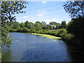
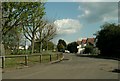
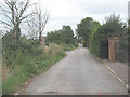
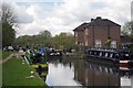
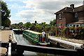
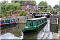
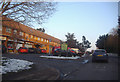
31 photos from this area
Area Information
Key information about the EN9 2NH including its size, population, and administrative classification.
- Area Type
- Postcode
- Area Size
- 11.6 hectares
- Population
- 1658
- Population Density
- 510 people/km²
House Prices in EN9 2NH
30
Properties
£449,597
Average Sold Price
£77,000
Lowest Price
£910,000
Highest Price
Showing 30 properties
| Address | Type | Beds | Baths | Last Sale Price | Last Sale Date | |
|---|---|---|---|---|---|---|
| 15 North Street, Nazeing, Waltham Abbey, EN9 2NH | Semi-detached | 4 | 2 | £465,000 | Jan 2024 | |
| Hayden House, 49 North Street, Nazeing, Waltham Abbey, EN9 2NH | Detached | 5 | 4 | £910,000 | Nov 2023 | |
| 57 North Street, Nazeing, Waltham Abbey, EN9 2NH | Detached | - | - | £310,000 | May 2023 | |
| 37 North Street, Nazeing, Waltham Abbey, EN9 2NH | house | - | - | £550,000 | Jun 2021 | |
| 13 North Street, Nazeing, Waltham Abbey, EN9 2NH | Detached | 4 | 1 | £750,000 | Jun 2021 | |
| 39 North Street, Nazeing, Waltham Abbey, EN9 2NH | Detached | 5 | 3 | £565,000 | Oct 2020 | |
| 5 North Street, Nazeing, Waltham Abbey, EN9 2NH | Detached | 3 | 2 | £535,000 | Jun 2019 | |
| 17 North Street, Nazeing, Waltham Abbey, EN9 2NH | Semi-detached | 3 | 2 | £545,000 | Dec 2017 | |
| Helena House, 47 North Street, Nazeing, Waltham Abbey, EN9 2NH | Detached | 5 | 4 | £790,000 | May 2017 | |
| 23 North Street, Nazeing, Waltham Abbey, EN9 2NH | Semi-detached | 3 | 2 | £527,000 | May 2017 |
Page 1 of 3
Energy Efficiency in EN9 2NH
Amenities
Schools
| Rank | School | Type | Entry gender | Ages |
|---|
Explore more schools in this area
Go to Schools tabDemographics
Household Size
Two person
most common
Accommodation Type
Houses
most common
Tenure
91
majority
Ethnic Group
White
most common
Religion
N/A
most common
Household Composition
N/A
most common
Age
47
median
Adults (30-64 years)
most common
Household Deprivation
N/A
with no deprivation
NS-SEC
36
in Lower managerial occupations
Explore more demographic insights in this area
Go to Demographics tabPlanning
Planning Constraints
- Flood RiskPremium
- Ramsar Wetland SitesPremium
- Area of Outstanding Natural BeautyPremium
- Protected Nature ReservePremium
- Protected WoodlandPremium