Area Overview for EN9 2DB
Photos of EN9 2DB
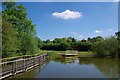
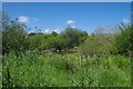
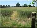
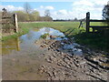

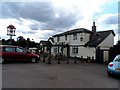
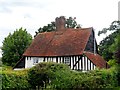
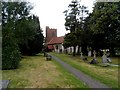
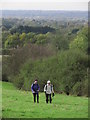
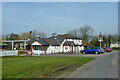
24 photos from this area
Area Information
Key information about the EN9 2DB including its size, population, and administrative classification.
- Area Type
- Postcode
- Area Size
- 41.0 hectares
- Population
- 1226
- Population Density
- 460 people/km²
House Prices in EN9 2DB
13
Properties
£750,714
Average Sold Price
£495,000
Lowest Price
£1,200,000
Highest Price
Showing 13 properties
| Address | Type | Beds | Baths | Last Sale Price | Last Sale Date | |
|---|---|---|---|---|---|---|
| Church Cottage, Betts Lane, Nazeing, Waltham Abbey, EN9 2DB | Detached | 2 | 1 | £525,000 | Aug 2024 | |
| Clarador, Betts Lane, Nazeing, Waltham Abbey, EN9 2DB | Bungalow | 4 | 1 | £880,000 | Mar 2020 | |
| Nazeby, Betts Lane, Nazeing, Waltham Abbey, EN9 2DB | Detached | 4 | - | £1,075,000 | Jun 2017 | |
| The Old Vicarage, Betts Lane, Nazeing, Waltham Abbey, EN9 2DB | Detached | 3 | - | £1,200,000 | Sep 2014 | |
| Fairview Cottage, Betts Lane, Nazeing, Waltham Abbey, EN9 2DB | Detached | 3 | 1 | £495,000 | Sep 2014 | |
| Mill House, Betts Lane, Nazeing, Waltham Abbey, EN9 2DB | Detached | 4 | 1 | £520,000 | Feb 2013 | |
| Glebe House, Betts Lane, Nazeing, Waltham Abbey, EN9 2DB | Semi-detached | - | - | £560,000 | Jul 2005 | |
| Mobile Home, Mill House, Betts Lane, Nazeing, Waltham Abbey, EN9 2DB | Mobile Home | - | - | - | - | |
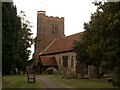
| All Saints Church, Betts Lane, Nazeing, Waltham Abbey, EN9 2DB | commercial | - | - | - | - | |
| The Vicarage, Betts Lane, Nazeing, Waltham Abbey, EN9 2DB | house | - | - | - | - |
Page 1 of 2
Energy Efficiency in EN9 2DB
Amenities
Schools
| Rank | School | Type | Entry gender | Ages |
|---|
Explore more schools in this area
Go to Schools tabDemographics
Household Size
Two person
most common
Accommodation Type
Houses
most common
Tenure
68
majority
Ethnic Group
White
most common
Religion
N/A
most common
Household Composition
N/A
most common
Age
47
median
Adults (30-64 years)
most common
Household Deprivation
N/A
with no deprivation
NS-SEC
32
in Lower managerial occupations
Explore more demographic insights in this area
Go to Demographics tabPlanning
Planning Constraints
- Flood RiskPremium
- Ramsar Wetland SitesPremium
- Area of Outstanding Natural BeautyPremium
- Protected Nature ReservePremium
- Protected WoodlandPremium