Area Overview for EN9 1UR
Photos of EN9 1UR

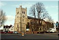
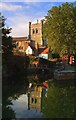
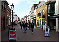
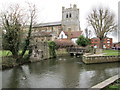
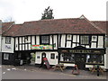
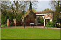
100 photos from this area
Area Information
Key information about the EN9 1UR including its size, population, and administrative classification.
- Area Type
- Postcode
- Area Size
- 2.4 hectares
- Population
- 1581
- Population Density
- 6474 people/km²
House Prices in EN9 1UR
60
Properties
£283,703
Average Sold Price
£69,500
Lowest Price
£435,000
Highest Price
Showing 60 properties
| Address | Type | Beds | Baths | Last Sale Price | Last Sale Date | |
|---|---|---|---|---|---|---|
| 15 Caldbeck, Waltham Abbey, EN9 1UR | Terraced | 3 | 1 | £410,000 | Dec 2025 | |
| 10 Caldbeck, Waltham Abbey, EN9 1UR | Terraced | 3 | 1 | £380,000 | Apr 2023 | |
| 7 Caldbeck, Waltham Abbey, EN9 1UR | Terraced | 3 | 1 | £377,000 | Mar 2023 | |
| 29 Caldbeck, Waltham Abbey, EN9 1UR | Terraced | 3 | 1 | £390,000 | Jan 2023 | |
| 25 Caldbeck, Waltham Abbey, EN9 1UR | Terraced | 3 | 1 | £390,105 | Dec 2022 | |
| 1 Caldbeck, Waltham Abbey, EN9 1UR | Terraced | 2 | 1 | £435,000 | Nov 2022 | |
| 35 Caldbeck, Waltham Abbey, EN9 1UR | Terraced | 3 | 1 | £395,000 | Oct 2022 | |
| 13 Caldbeck, Waltham Abbey, EN9 1UR | Retail | 3 | 2 | £435,000 | May 2022 | |
| 27 Caldbeck, Waltham Abbey, EN9 1UR | house | - | - | £372,000 | Oct 2021 | |
| 31 Caldbeck, Waltham Abbey, EN9 1UR | house | 3 | 1 | £365,000 | Jan 2021 |
Page 1 of 6
Energy Efficiency in EN9 1UR
Amenities
Schools
| Rank | School | Type | Entry gender | Ages |
|---|
Explore more schools in this area
Go to Schools tabDemographics
Household Size
Family (3-5 people)
most common
Accommodation Type
Houses
most common
Tenure
55
majority
Ethnic Group
White
most common
Religion
N/A
most common
Household Composition
N/A
most common
Age
47
median
Adults (30-64 years)
most common
Household Deprivation
N/A
with no deprivation
NS-SEC
21
in Lower managerial occupations
Explore more demographic insights in this area
Go to Demographics tabPlanning
Planning Constraints
- Flood RiskPremium
- Ramsar Wetland SitesPremium
- Area of Outstanding Natural BeautyPremium
- Protected Nature ReservePremium
- Protected WoodlandPremium