Area Overview for EN9 1SU
Photos of EN9 1SU
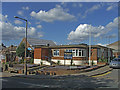
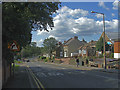
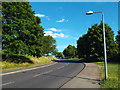
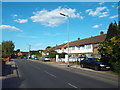
5 photos from this area
Area Information
Key information about the EN9 1SU including its size, population, and administrative classification.
- Area Type
- Postcode
- Area Size
- 5563 m²
- Population
- 1581
- Population Density
- 6474 people/km²
House Prices in EN9 1SU
18
Properties
£192,533
Average Sold Price
£48,000
Lowest Price
£328,488
Highest Price
Showing 18 properties
| Address | Type | Beds | Baths | Last Sale Price | Last Sale Date | |
|---|---|---|---|---|---|---|
| 11 The Dale, Waltham Abbey, EN9 1SU | Maisonette | 3 | - | £328,488 | Feb 2025 | |
| 7 The Dale, Waltham Abbey, EN9 1SU | Flat | 2 | 1 | £290,000 | Jul 2023 | |
| 10 The Dale, Waltham Abbey, EN9 1SU | Maisonette | 3 | 1 | £295,000 | Sep 2022 | |
| 9 The Dale, Waltham Abbey, EN9 1SU | Maisonette | 2 | 1 | £305,000 | Feb 2022 | |
| 12 The Dale, Waltham Abbey, EN9 1SU | Maisonette | - | - | £240,000 | Jul 2021 | |
| 3 The Dale, Waltham Abbey, EN9 1SU | house | 3 | 2 | £295,000 | Jul 2016 | |
| 5 The Dale, Waltham Abbey, EN9 1SU | Terraced | - | - | £175,000 | Aug 2009 | |
| 16 The Dale, Waltham Abbey, EN9 1SU | Flat | - | - | £180,000 | Oct 2007 | |
| 15 The Dale, Waltham Abbey, EN9 1SU | Flat | - | - | £150,000 | Nov 2005 | |
| 4 The Dale, Waltham Abbey, EN9 1SU | Terraced | - | - | £165,000 | Aug 2004 |
Page 1 of 2
Energy Efficiency in EN9 1SU
Amenities
Schools
| Rank | School | Type | Entry gender | Ages |
|---|
Explore more schools in this area
Go to Schools tabDemographics
Household Size
Family (3-5 people)
most common
Accommodation Type
Houses
most common
Tenure
55
majority
Ethnic Group
White
most common
Religion
N/A
most common
Household Composition
N/A
most common
Age
47
median
Adults (30-64 years)
most common
Household Deprivation
N/A
with no deprivation
NS-SEC
21
in Lower managerial occupations
Explore more demographic insights in this area
Go to Demographics tabPlanning
Planning Constraints
- Flood RiskPremium
- Ramsar Wetland SitesPremium
- Area of Outstanding Natural BeautyPremium
- Protected Nature ReservePremium
- Protected WoodlandPremium