Area Overview for EN9 1SG
Photos of EN9 1SG
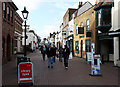
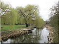
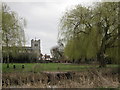
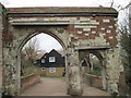
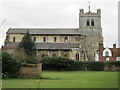
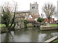
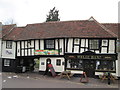
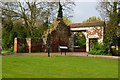
100 photos from this area
Area Information
Key information about the EN9 1SG including its size, population, and administrative classification.
- Area Type
- Postcode
- Area Size
- 4182 m²
- Population
- 1407
- Population Density
- 5011 people/km²
House Prices in EN9 1SG
28
Properties
£199,341
Average Sold Price
£48,000
Lowest Price
£310,000
Highest Price
Showing 28 properties
| Address | Type | Beds | Baths | Last Sale Price | Last Sale Date | |
|---|---|---|---|---|---|---|
| 40 Cedar Walk, Waltham Abbey, EN9 1SG | Maisonette | 2 | 1 | £295,000 | Aug 2025 | |
| 52 Cedar Walk, Waltham Abbey, EN9 1SG | Flat | 2 | 1 | £285,000 | Jul 2023 | |
| 14 Cedar Walk, Waltham Abbey, EN9 1SG | Flat | - | - | £270,000 | Oct 2022 | |
| 24 Cedar Walk, Waltham Abbey, EN9 1SG | Maisonette | 2 | 1 | £290,000 | Jun 2019 | |
| 30 Cedar Walk, Waltham Abbey, EN9 1SG | Maisonette | 2 | 1 | £284,000 | Jan 2018 | |
| 4 Cedar Walk, Waltham Abbey, EN9 1SG | Flat | - | - | £310,000 | Aug 2017 | |
| 38 Cedar Walk, Waltham Abbey, EN9 1SG | Flat | - | - | £300,000 | Jan 2017 | |
| 42 Cedar Walk, Waltham Abbey, EN9 1SG | Flat | - | - | £270,000 | Aug 2016 | |
| 56 Cedar Walk, Waltham Abbey, EN9 1SG | Flat | 2 | 1 | £260,000 | Oct 2015 | |
| 44 Cedar Walk, Waltham Abbey, EN9 1SG | Flat | 2 | 1 | £250,000 | Sep 2015 |
Page 1 of 3
Energy Efficiency in EN9 1SG
Amenities
Schools
| Rank | School | Type | Entry gender | Ages |
|---|
Explore more schools in this area
Go to Schools tabDemographics
Household Size
Two person
most common
Accommodation Type
Houses
most common
Tenure
82
majority
Ethnic Group
White
most common
Religion
N/A
most common
Household Composition
N/A
most common
Age
47
median
Adults (30-64 years)
most common
Household Deprivation
N/A
with no deprivation
NS-SEC
31
in Lower managerial occupations
Explore more demographic insights in this area
Go to Demographics tabPlanning
Planning Constraints
- Flood RiskPremium
- Ramsar Wetland SitesPremium
- Area of Outstanding Natural BeautyPremium
- Protected Nature ReservePremium
- Protected WoodlandPremium