Area Overview for EN9 1DF
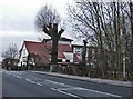
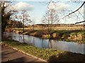
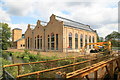
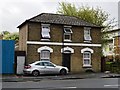
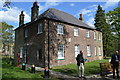
Photos of EN9 1DF


Area Information
Living in EN9 1DF means inhabiting a compact, residential postcode area in England with a population of 2042 people spread across a densely populated 1013 people per square kilometre. This small cluster of homes is defined by its proximity to transport networks and retail hubs, making it a practical choice for those prioritising accessibility. The area’s character is shaped by its mix of flats, which dominate the housing stock, and a community skewed towards adults aged 30–64. Daily life here is punctuated by the convenience of nearby shops, including Co-op Waltham and Tesco Waltham, and the ease of reaching multiple railway and underground stations. While the area lacks natural landscapes or protected sites, its strategic location near Waltham Cross and Buckhurst Hill ensures residents are well-connected to broader regional amenities. The demographic profile suggests a mature, stable population, with home ownership at 50%, reflecting a balance between owner-occupied and rental properties. EN9 1DF is not a place for those seeking sprawling green spaces, but it offers a tightly woven neighbourhood where practicality and connectivity take precedence.
- Area Type
- Postcode
- Area Size
- Not available
- Population
- 2042
- Population Density
- 1013 people/km²
The property market in EN9 1DF is characterised by a high concentration of flats, with no indication of detached or semi-detached homes. Home ownership sits at 50%, meaning half the properties are rented, suggesting a rental market that caters to both long-term tenants and short-term lets. This dynamic may appeal to buyers seeking investment opportunities or first-time buyers looking for affordable entry points into the housing market. The compact nature of the area, combined with its proximity to transport hubs, makes it a niche market for those prioritising location over space. However, the limited housing stock and lack of larger properties could pose challenges for families or those requiring more living space. For buyers, the area’s small size means competition for available properties, but the presence of multiple railway and underground stations nearby could enhance its appeal for commuters.
House Prices in EN9 1DF
No properties found in this postcode.
Energy Efficiency in EN9 1DF
Life in EN9 1DF is shaped by its proximity to retail and transport hubs. Residents have easy access to shops like Co-op Waltham, Tesco Waltham, and Lidl Waltham, ensuring daily essentials are within walking or short driving distance. The area’s transport links are extensive, with five railway stations and three underground stops, including Waltham Cross and Buckhurst Hill, providing frequent connections to London and surrounding towns. While the postcode itself lacks parks or leisure facilities, its location near larger centres means residents can access recreational spaces, dining options, and cultural attractions in nearby areas. The retail presence and transport infrastructure create a lifestyle that prioritises convenience, making it ideal for those who value accessibility over secluded, rural living. The compact nature of the area ensures that amenities are never far, though the absence of local parks or natural spaces may be a drawback for some.
Amenities
Schools
| Rank | School | Type | Entry gender | Ages |
|---|
Explore more schools in this area
Go to Schools tabDemographics
The community in EN9 1DF is predominantly composed of adults aged 30–64, with a median age of 47. This suggests a population that is largely in their prime working years, potentially influencing local employment patterns and service demands. Home ownership stands at 50%, indicating a split between owner-occupied and rental properties. The area’s accommodation is almost entirely flats, reflecting a housing stock tailored to smaller households or those seeking low-maintenance living. The predominant ethnic group is White, though no specific data on diversity or deprivation is provided. The age profile and home ownership figures suggest a stable, middle-aged population with established routines. With no evidence of high deprivation, the area appears to support a quality of life that aligns with its practical amenities and transport links. However, the lack of detailed demographic breakdowns means assumptions about cultural diversity or socioeconomic variation remain unconfirmed.
Household Size
Accommodation Type
Tenure
Ethnic Group
Religion
Household Composition
Age
Household Deprivation
NS-SEC
Explore more demographic insights in this area
Go to Demographics tabPlanning
Planning Constraints
- Flood RiskPremium
- Ramsar Wetland SitesPremium
- Area of Outstanding Natural BeautyPremium
- Protected Nature ReservePremium
- Protected WoodlandPremium