Area Overview for EN9 1DE
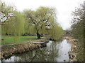
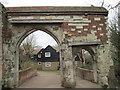
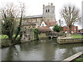
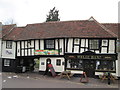
Photos of EN9 1DE


Area Information
EN9 1DE is a compact residential postcode in England, covering 1275 square metres and home to 2042 residents. Its population density of 1013 people per square kilometre reflects a tightly knit community, where daily life is shaped by proximity to amenities and transport links. The area is characterised by its mix of practical living and accessibility, with residents benefiting from nearby retail hubs, rail services, and underground stations. While the postcode is small, it offers a balance of convenience and space, with flats forming the predominant housing type. The median age of 47 suggests a mature demographic, with many residents in their 30s to 60s, contributing to a stable, established neighbourhood. Living here means navigating a blend of suburban comfort and urban connectivity, though challenges like flood risk and crime rates are factors to consider. For those seeking a self-contained lifestyle within reach of essential services, EN9 1DE provides a distinct, if modest, footprint in the region.
- Area Type
- Postcode
- Area Size
- 1275 m²
- Population
- 2042
- Population Density
- 1013 people/km²
The property market in EN9 1DE is largely defined by its flat-based housing stock, with flats accounting for the majority of accommodation. Home ownership stands at 50%, suggesting a balanced split between owner-occupied and rental properties. This implies that while some residents are invested in long-term residency, others may be in the rental market, potentially affecting property values and availability. The small area size of 1275 square metres means the housing stock is limited, requiring buyers to consider nearby areas for more options. Flats in this postcode likely cater to those prioritising convenience over space, given the proximity to transport and retail. For buyers, this could mean a competitive market with limited scope for expansion, necessitating a focus on the immediate surroundings for larger properties or alternative housing types.
House Prices in EN9 1DE
No properties found in this postcode.
Energy Efficiency in EN9 1DE
Daily life in EN9 1DE is supported by a range of nearby amenities, including five retail outlets such as Co-op Waltham, Tesco Waltham, and Lidl Waltham, ensuring easy access to groceries and everyday essentials. The proximity to rail and metro stations—Waltham Cross, Theobalds Grove, and Cheshunt—enhances mobility, connecting residents to broader networks for shopping, leisure, and employment. While the data does not specify parks or recreational facilities, the availability of multiple transport hubs and retail options suggests a practical, service-oriented lifestyle. The area’s compact nature means amenities are within walking or short-vehicle distance, though residents may need to venture slightly further for specialist services. This balance of convenience and accessibility defines the character of living in EN9 1DE.
Amenities
Schools
| Rank | School | Type | Entry gender | Ages |
|---|
Explore more schools in this area
Go to Schools tabDemographics
The community in EN9 1DE is predominantly composed of adults aged 30 to 64, with a median age of 47. This suggests a mature, settled population, likely with established careers and families. Home ownership sits at 50%, indicating a mix of owner-occupied and rental properties, though flats are the primary accommodation type. The predominant ethnic group is White, reflecting the area’s demographic profile. With a population density of 1013 people per square kilometre, the area is moderately crowded, which may influence the pace of life and availability of private space. While no specific data on deprivation is provided, the high proportion of adults in their prime working years may contribute to a stable local economy. However, the lack of detailed diversity metrics means broader social dynamics remain less defined.
Household Size
Accommodation Type
Tenure
Ethnic Group
Religion
Household Composition
Age
Household Deprivation
NS-SEC
Explore more demographic insights in this area
Go to Demographics tabPlanning
Planning Constraints
- Flood RiskPremium
- Ramsar Wetland SitesPremium
- Area of Outstanding Natural BeautyPremium
- Protected Nature ReservePremium
- Protected WoodlandPremium