Area Overview for EN8 8BF
Photos of EN8 8BF


Area Information
EN8 8BF is a small, tightly knit residential area in England, home to around 2,382 people. Its compact size fosters a quiet, community-focused atmosphere, typical of smaller postcode clusters. The area’s demographic profile suggests a stable, mature population, with a median age of 47 and a strong presence of adults aged 30–64. This hints at a mix of long-term residents and families, contributing to a balanced local economy. Daily life here is shaped by proximity to essential services and transport links, with multiple railway stations and retail hubs within reach. The absence of significant environmental constraints—such as flood risk or protected natural areas—means residents face minimal planning restrictions, which can simplify home improvements or development. While the area’s small size limits its diversity of amenities, its strategic location near major transport routes ensures connectivity to larger towns and cities. For buyers, EN8 8BF offers a blend of low crime risk, reliable digital connectivity, and a sense of security that appeals to those seeking a settled lifestyle without urban congestion.
- Area Type
- Postcode
- Area Size
- Not available
- Population
- 2382
- Population Density
- 4338 people/km²
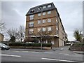
EN8 8BF is characterised by a strong owner-occupied market, with 63% of homes owned by their residents. This suggests a stable housing stock, predominantly composed of houses rather than flats or apartments. The prevalence of owner-occupation indicates a community with long-term residents, which can influence property values and demand. As a small postcode area, the housing stock is likely limited, meaning buyers may need to consider nearby regions for more options. The focus on houses implies a market suited to families or those seeking larger living spaces, though the lack of data on rental properties means it is unclear how much of the housing stock is available for rent. For those considering purchase, the area’s low crime risk and reliable digital connectivity may enhance its appeal, though the compact size could limit availability for those seeking specific property types or features.
House Prices in EN8 8BF
No properties found in this postcode.
Energy Efficiency in EN8 8BF
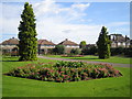
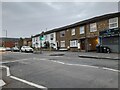
Daily life in EN8 8BF is shaped by its proximity to essential retail and transport hubs. Within reach are major supermarkets such as Tesco Waltham Cross, Aldi Sturlas Way, and Sainsburys Waltham, offering convenience for grocery shopping and daily errands. The area’s rail and metro stations, including Theobalds Grove and Waltham Cross, provide easy access to larger towns and cities, supporting both work and leisure travel. While the area itself is small, its transport links open up opportunities for dining, entertainment, and cultural activities in nearby centres. The lack of large parks or leisure facilities within EN8 8BF means residents may need to travel to adjacent areas for such amenities, but the compact layout ensures most needs are met locally. This balance of convenience and connectivity makes the area suitable for those prioritising accessibility over sprawling green spaces.
Amenities
Schools
| Rank | School | Type | Entry gender | Ages |
|---|
Explore more schools in this area
Go to Schools tabDemographics
The population of EN8 8BF skews towards middle-aged adults, with a median age of 47 and 63% of residents owning their homes. This suggests a community of long-term residents, many of whom are likely to be in their prime working years. The predominant accommodation type is houses, reflecting a preference for family-friendly or more spacious living arrangements. The area is predominantly White, with no specific data provided on other ethnic groups. While the data does not quantify deprivation levels, the high home ownership rate and low crime risk imply a relatively stable socioeconomic environment. The absence of younger demographics or student populations means the area is less likely to experience the transient nature of student housing or rental turnover. For buyers, this demographic profile indicates a mature market with fewer speculative pressures, though it may also mean limited demand from first-time buyers or younger families.
Household Size
Accommodation Type
Tenure
Ethnic Group
Religion
Household Composition
Age
Household Deprivation
NS-SEC
Explore more demographic insights in this area
Go to Demographics tabPlanning
Planning Constraints
- Flood RiskPremium
- Ramsar Wetland SitesPremium
- Area of Outstanding Natural BeautyPremium
- Protected Nature ReservePremium
- Protected WoodlandPremium
- Crime RiskPremium