Area Overview for EN7 6HJ
Photos of EN7 6HJ
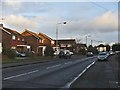
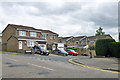
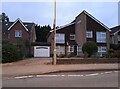
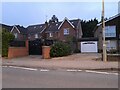
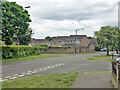
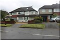
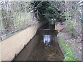
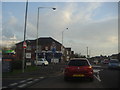
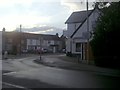
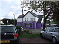
10 photos from this area
Area Information
Key information about the EN7 6HJ including its size, population, and administrative classification.
- Area Type
- Postcode
- Area Size
- 6040 m²
- Population
- 1406
- Population Density
- 7527 people/km²
House Prices in EN7 6HJ
44
Properties
£168,737
Average Sold Price
£63,500
Lowest Price
£447,500
Highest Price
Showing 44 properties
| Address | Type | Beds | Baths | Last Sale Price | Last Sale Date | |
|---|---|---|---|---|---|---|
| 43 Cranleigh Close, Cheshunt, EN7 6HJ | Flat | 1 | 1 | £163,000 | Apr 2025 | |
| 50 Cranleigh Close, Cheshunt, EN7 6HJ | Flat | 1 | - | £175,000 | Feb 2025 | |
| 66 Cranleigh Close, Cheshunt, EN7 6HJ | Terraced | 2 | 1 | £361,000 | Mar 2024 | |
| 60 Cranleigh Close, Cheshunt, EN7 6HJ | Maisonette | 2 | 1 | £245,000 | Feb 2024 | |
| 48 Cranleigh Close, Cheshunt, EN7 6HJ | Flat | 1 | 1 | £130,000 | Apr 2023 | |
| 73 Cranleigh Close, Cheshunt, EN7 6HJ | Terraced | 4 | 1 | £447,500 | Mar 2022 | |
| 52 Cranleigh Close, Cheshunt, EN7 6HJ | Flat | - | - | £167,500 | May 2021 | |
| 63 Cranleigh Close, Cheshunt, EN7 6HJ | Terraced | 2 | 1 | £330,000 | Jul 2020 | |
| 36 Cranleigh Close, Cheshunt, EN7 6HJ | Flat | 1 | 1 | £164,772 | Feb 2019 | |
| 75 Cranleigh Close, Cheshunt, EN7 6HJ | Terraced | 2 | 1 | £308,000 | Dec 2018 |
Page 1 of 5
Energy Efficiency in EN7 6HJ
Amenities
Schools
| Rank | School | Type | Entry gender | Ages |
|---|
Explore more schools in this area
Go to Schools tabDemographics
Household Size
One person
most common
Accommodation Type
Houses
most common
Tenure
75
majority
Ethnic Group
White
most common
Religion
N/A
most common
Household Composition
N/A
most common
Age
47
median
Adults (30-64 years)
most common
Household Deprivation
N/A
with no deprivation
NS-SEC
27
in Lower managerial occupations
Explore more demographic insights in this area
Go to Demographics tabPlanning
Planning Constraints
- Flood RiskPremium
- Ramsar Wetland SitesPremium
- Area of Outstanding Natural BeautyPremium
- Protected Nature ReservePremium
- Protected WoodlandPremium