Area Overview for EN7 5RY
Photos of EN7 5RY
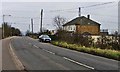


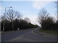
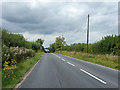

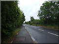

10 photos from this area
Area Information
Key information about the EN7 5RY including its size, population, and administrative classification.
- Area Type
- Postcode
- Area Size
- 56.1 hectares
- Population
- 1630
- Population Density
- 390 people/km²
House Prices in EN7 5RY
10
Properties
£874,400
Average Sold Price
£245,000
Lowest Price
£2,300,000
Highest Price
Showing 10 properties
| Address | Type | Beds | Baths | Last Sale Price | Last Sale Date | |
|---|---|---|---|---|---|---|
| Laurel Park, Newgatestreet Road, Goffs Oak, EN7 5RY | house | - | - | £2,300,000 | Feb 2022 | |
| The Nest, Newgatestreet Road, Goffs Oak, EN7 5RY | Detached | 4 | 3 | £1,187,000 | Nov 2019 | |
| Valley View, Newgatestreet Road, Goffs Oak, EN7 5RY | Bungalow | - | - | £340,000 | Aug 2014 | |
| Four Winds, Newgatestreet Road, Goffs Oak, EN7 5RY | Detached | 5 | 3 | £245,000 | Aug 1996 | |
| Burleigh Farm House, Newgatestreet Road, Goffs Oak, EN7 5RY | Detached | - | - | £300,000 | Mar 1996 | |
| Tetherdown Nursery, Newgatestreet Road, Goffs Oak, EN7 5RY | Land | - | - | - | - | |
| Pembrey, Newgatestreet Road, Goffs Oak, EN7 5RY | Bungalow | 4 | 1 | - | - | |
| Ashfield House, Newgatestreet Road, Goffs Oak, EN7 5RY | house | - | - | - | - | |
| Forest View, Newgatestreet Road, Goffs Oak, EN7 5RY | Detached | - | - | - | - | |
| Linden Cottage, Newgatestreet Road, Goffs Oak, EN7 5RY | Detached | - | - | - | - |
Energy Efficiency in EN7 5RY
Amenities
Schools
| Rank | School | Type | Entry gender | Ages |
|---|
Explore more schools in this area
Go to Schools tabDemographics
Household Size
Family (3-5 people)
most common
Accommodation Type
Houses
most common
Tenure
92
majority
Ethnic Group
White
most common
Religion
N/A
most common
Household Composition
N/A
most common
Age
47
median
Adults (30-64 years)
most common
Household Deprivation
N/A
with no deprivation
NS-SEC
41
in Lower managerial occupations
Explore more demographic insights in this area
Go to Demographics tabPlanning
Planning Constraints
- Flood RiskPremium
- Ramsar Wetland SitesPremium
- Area of Outstanding Natural BeautyPremium
- Protected Nature ReservePremium
- Protected WoodlandPremium