Area Overview for EN7 5RX
Photos of EN7 5RX
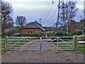
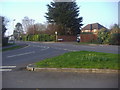
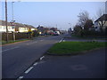

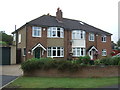
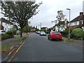


9 photos from this area
Area Information
Key information about the EN7 5RX including its size, population, and administrative classification.
- Area Type
- Postcode
- Area Size
- 2.2 hectares
- Population
- 1630
- Population Density
- 390 people/km²
House Prices in EN7 5RX
19
Properties
£632,246
Average Sold Price
£352,500
Lowest Price
£1,290,000
Highest Price
Showing 19 properties
| Address | Type | Beds | Baths | Last Sale Price | Last Sale Date | |
|---|---|---|---|---|---|---|
| 141 Newgatestreet Road, Goffs Oak, EN7 5RX | Detached | 5 | - | £1,290,000 | Nov 2023 | |
| Millfield, 123 Newgatestreet Road, Goffs Oak, EN7 5RX | Detached | 3 | 1 | £800,000 | Jan 2023 | |
| 131 Newgatestreet Road, Goffs Oak, EN7 5RX | house | - | - | £565,000 | Jan 2022 | |
| 145 Newgatestreet Road, Goffs Oak, EN7 5RX | Detached | 4 | - | £765,000 | Jun 2021 | |
| 149 Newgatestreet Road, Goffs Oak, EN7 5RX | Detached | 4 | 1 | £580,000 | Nov 2017 | |
| 147 Newgatestreet Road, Goffs Oak, EN7 5RX | Detached | 4 | 2 | £562,500 | Feb 2017 | |
| 137 Newgatestreet Road, Goffs Oak, EN7 5RX | Semi-detached | 3 | 1 | £487,000 | Jun 2016 | |
| 129 Newgatestreet Road, Goffs Oak, EN7 5RX | house | - | - | £439,950 | Oct 2014 | |
| Lyncroft, 117 Newgatestreet Road, Goffs Oak, EN7 5RX | house | - | - | £635,000 | Nov 2013 | |
| Kalma, 125 Newgatestreet Road, Goffs Oak, EN7 5RX | Semi-detached | - | - | £580,000 | Oct 2009 |
Page 1 of 2
Energy Efficiency in EN7 5RX
Amenities
Schools
| Rank | School | Type | Entry gender | Ages |
|---|
Explore more schools in this area
Go to Schools tabDemographics
Household Size
Family (3-5 people)
most common
Accommodation Type
Houses
most common
Tenure
92
majority
Ethnic Group
White
most common
Religion
N/A
most common
Household Composition
N/A
most common
Age
47
median
Adults (30-64 years)
most common
Household Deprivation
N/A
with no deprivation
NS-SEC
41
in Lower managerial occupations
Explore more demographic insights in this area
Go to Demographics tabPlanning
Planning Constraints
- Flood RiskPremium
- Ramsar Wetland SitesPremium
- Area of Outstanding Natural BeautyPremium
- Protected Nature ReservePremium
- Protected WoodlandPremium