Area Overview for EN7 5EG
Photos of EN7 5EG
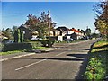
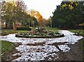
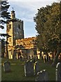
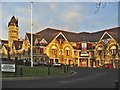

31 photos from this area
Area Information
Key information about the EN7 5EG including its size, population, and administrative classification.
- Area Type
- Postcode
- Area Size
- 1.1 hectares
- Population
- 1391
- Population Density
- 4114 people/km²
House Prices in EN7 5EG
21
Properties
£271,192
Average Sold Price
£103,000
Lowest Price
£499,995
Highest Price
Showing 21 properties
| Address | Type | Beds | Baths | Last Sale Price | Last Sale Date | |
|---|---|---|---|---|---|---|
| 15 Goffs Lane, Cheshunt, EN7 5EG | Terraced | 4 | 2 | £499,995 | Dec 2024 | |
| 19 Goffs Lane, Cheshunt, EN7 5EG | Terraced | 3 | 1 | £214,000 | Jun 2023 | |
| 3 Goffs Lane, Cheshunt, EN7 5EG | Semi-detached | 3 | 2 | £355,000 | Mar 2017 | |
| 25 Goffs Lane, Cheshunt, EN7 5EG | Terraced | 3 | 1 | £372,000 | Feb 2017 | |
| 23 Goffs Lane, Cheshunt, EN7 5EG | Terraced | 3 | 1 | £347,500 | Sep 2016 | |
| 7 Goffs Lane, Cheshunt, EN7 5EG | Semi-detached | 3 | 1 | £310,000 | Nov 2014 | |
| 5 Goffs Lane, Cheshunt, EN7 5EG | Semi-detached | 4 | 3 | £245,000 | Sep 2013 | |
| 35 Goffs Lane, Cheshunt, EN7 5EG | Detached | 4 | 2 | £228,000 | Dec 2008 | |
| 39 Goffs Lane, Cheshunt, EN7 5EG | Terraced | - | - | £250,000 | Jul 2007 | |
| 11 Goffs Lane, Cheshunt, EN7 5EG | Terraced | - | - | £233,000 | Jan 2007 |
Page 1 of 3
Energy Efficiency in EN7 5EG
Amenities
Schools
| Rank | School | Type | Entry gender | Ages |
|---|
Explore more schools in this area
Go to Schools tabDemographics
Household Size
Family (3-5 people)
most common
Accommodation Type
Houses
most common
Tenure
76
majority
Ethnic Group
White
most common
Religion
N/A
most common
Household Composition
N/A
most common
Age
47
median
Adults (30-64 years)
most common
Household Deprivation
N/A
with no deprivation
NS-SEC
28
in Lower managerial occupations
Explore more demographic insights in this area
Go to Demographics tabPlanning
Planning Constraints
- Flood RiskPremium
- Ramsar Wetland SitesPremium
- Area of Outstanding Natural BeautyPremium
- Protected Nature ReservePremium
- Protected WoodlandPremium