Area Overview for EN7 5DR
Photos of EN7 5DR
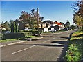
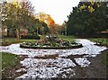
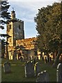
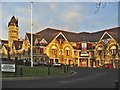
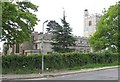
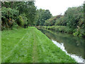
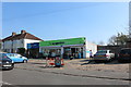
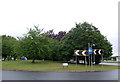
31 photos from this area
Area Information
Key information about the EN7 5DR including its size, population, and administrative classification.
- Area Type
- Postcode
- Area Size
- 8853 m²
- Population
- 1953
- Population Density
- 4802 people/km²
House Prices in EN7 5DR
34
Properties
£280,426
Average Sold Price
£53,000
Lowest Price
£535,000
Highest Price
Showing 34 properties
| Address | Type | Beds | Baths | Last Sale Price | Last Sale Date | |
|---|---|---|---|---|---|---|
| 29 Lordship Road, Cheshunt, EN7 5DR | Terraced | 3 | 1 | £420,000 | May 2025 | |
| 49 Lordship Road, Cheshunt, EN7 5DR | Terraced | 3 | 1 | £421,000 | May 2024 | |
| 41 Lordship Road, Cheshunt, EN7 5DR | Terraced | 2 | 1 | £192,500 | Jun 2023 | |
| The Wrens, Lordship Road, Cheshunt, EN7 5DR | house | - | - | £535,000 | May 2022 | |
| 31 Lordship Road, Cheshunt, EN7 5DR | house | - | - | £385,000 | May 2021 | |
| 39 Lordship Road, Cheshunt, EN7 5DR | Terraced | 3 | 1 | £387,500 | Feb 2021 | |
| 61 Lordship Road, Cheshunt, EN7 5DR | Terraced | 4 | 2 | £338,000 | Jul 2020 | |
| 25 Lordship Road, Cheshunt, EN7 5DR | Semi-detached | 4 | 2 | £490,000 | Jun 2018 | |
| 47 Lordship Road, Cheshunt, EN7 5DR | Terraced | 3 | 1 | £320,000 | Nov 2016 | |
| 51 Lordship Road, Cheshunt, EN7 5DR | Terraced | 3 | - | £335,000 | Mar 2016 |
Page 1 of 4
Energy Efficiency in EN7 5DR
Amenities
Schools
| Rank | School | Type | Entry gender | Ages |
|---|
Explore more schools in this area
Go to Schools tabDemographics
Household Size
Family (3-5 people)
most common
Accommodation Type
Houses
most common
Tenure
66
majority
Ethnic Group
White
most common
Religion
N/A
most common
Household Composition
N/A
most common
Age
47
median
Adults (30-64 years)
most common
Household Deprivation
N/A
with no deprivation
NS-SEC
29
in Lower managerial occupations
Explore more demographic insights in this area
Go to Demographics tabPlanning
Planning Constraints
- Flood RiskPremium
- Ramsar Wetland SitesPremium
- Area of Outstanding Natural BeautyPremium
- Protected Nature ReservePremium
- Protected WoodlandPremium