Area Overview for EN7 5AL
Photos of EN7 5AL
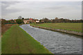
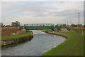
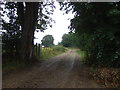
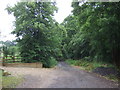
33 photos from this area
Area Information
Key information about the EN7 5AL including its size, population, and administrative classification.
- Area Type
- Postcode
- Area Size
- 4.9 hectares
- Population
- 1745
- Population Density
- 485 people/km²
House Prices in EN7 5AL
24
Properties
£203,300
Average Sold Price
£66,500
Lowest Price
£325,500
Highest Price
Showing 24 properties
| Address | Type | Beds | Baths | Last Sale Price | Last Sale Date | |
|---|---|---|---|---|---|---|
| 132 Bury Green Road, Cheshunt, EN7 5AL | Maisonette | 2 | 1 | £265,000 | Jul 2025 | |
| 174 Bury Green Road, Cheshunt, EN7 5AL | Maisonette | 2 | 1 | £285,000 | May 2024 | |
| 148 Bury Green Road, Cheshunt, EN7 5AL | Retail | 2 | 1 | £325,500 | Sep 2022 | |
| 164 Bury Green Road, Cheshunt, EN7 5AL | Flat | 2 | 1 | £289,000 | Sep 2021 | |
| 146 Bury Green Road, Cheshunt, EN7 5AL | Flat | 2 | - | £313,500 | Jun 2021 | |
| 160 Bury Green Road, Cheshunt, EN7 5AL | Maisonette | 2 | - | £277,500 | Oct 2018 | |
| 168 Bury Green Road, Cheshunt, EN7 5AL | Maisonette | - | - | £244,500 | Mar 2016 | |
| 170 Bury Green Road, Cheshunt, EN7 5AL | Maisonette | 2 | 1 | £237,500 | Sep 2015 | |
| 172 Bury Green Road, Cheshunt, EN7 5AL | Maisonette | - | - | £235,000 | Sep 2015 | |
| 162 Bury Green Road, Cheshunt, EN7 5AL | Maisonette | 2 | 1 | £232,000 | Aug 2015 |
Page 1 of 3
Energy Efficiency in EN7 5AL
Amenities
Schools
| Rank | School | Type | Entry gender | Ages |
|---|
Explore more schools in this area
Go to Schools tabDemographics
Household Size
Family (3-5 people)
most common
Accommodation Type
Houses
most common
Tenure
80
majority
Ethnic Group
White
most common
Religion
N/A
most common
Household Composition
N/A
most common
Age
47
median
Adults (30-64 years)
most common
Household Deprivation
N/A
with no deprivation
NS-SEC
28
in Lower managerial occupations
Explore more demographic insights in this area
Go to Demographics tabPlanning
Planning Constraints
- Flood RiskPremium
- Ramsar Wetland SitesPremium
- Area of Outstanding Natural BeautyPremium
- Protected Nature ReservePremium
- Protected WoodlandPremium