Area Overview for EN6 3HR
Photos of EN6 3HR
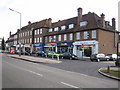
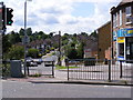
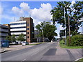

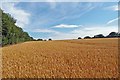


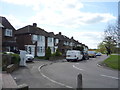

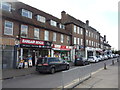
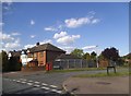
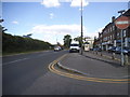
21 photos from this area
Area Information
Key information about the EN6 3HR including its size, population, and administrative classification.
- Area Type
- Postcode
- Area Size
- 3160 m²
- Population
- Not available
- Population Density
- Not available
House Prices in EN6 3HR
14
Properties
£111,900
Average Sold Price
£49,000
Lowest Price
£250,000
Highest Price
Showing 14 properties
| Address | Type | Beds | Baths | Last Sale Price | Last Sale Date | |
|---|---|---|---|---|---|---|
| 60 Shillitoe Avenue, Potters Bar, EN6 3HR | Flat | - | - | £250,000 | Sep 2021 | |
| 78 Shillitoe Avenue, Potters Bar, EN6 3HR | Flat | - | - | £147,500 | Sep 2011 | |
| 68 Shillitoe Avenue, Potters Bar, EN6 3HR | Flat | - | - | £56,000 | Dec 1998 | |
| 76 Shillitoe Avenue, Potters Bar, EN6 3HR | Flat | - | - | £49,000 | Oct 1998 | |
| 66 Shillitoe Avenue, Potters Bar, EN6 3HR | Flat | - | - | £57,000 | Apr 1998 | |
| 58-80 Shillitoe Avenue, Potters Bar, EN6 3HR | Flat | - | - | - | - | |
| 70-80 Shillitoe Avenue, Potters Bar, EN6 3HR | Flat | - | - | - | - | |
| 70 Shillitoe Avenue, Potters Bar, EN6 3HR | Flat | - | - | - | - | |
| 58 Shillitoe Avenue, Potters Bar, EN6 3HR | Flat | - | - | - | - | |
| 62 Shillitoe Avenue, Potters Bar, EN6 3HR | Flat | - | - | - | - |
Page 1 of 2
Energy Efficiency in EN6 3HR
Amenities
Schools
| Rank | School | Type | Entry gender | Ages |
|---|
Explore more schools in this area
Go to Schools tabDemographics
Household Size
Family (3-5 people)
most common
Accommodation Type
Houses
most common
Tenure
70
majority
Ethnic Group
White
most common
Religion
N/A
most common
Household Composition
N/A
most common
Age
47
median
Adults (30-64 years)
most common
Household Deprivation
N/A
with no deprivation
NS-SEC
36
in Lower managerial occupations
Explore more demographic insights in this area
Go to Demographics tabPlanning
Planning Constraints
- Flood RiskPremium
- Ramsar Wetland SitesPremium
- Area of Outstanding Natural BeautyPremium
- Protected Nature ReservePremium
- Protected WoodlandPremium