Area Overview for EN6 3DE
Photos of EN6 3DE
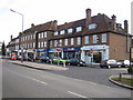
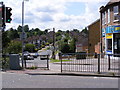
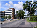

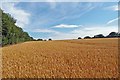


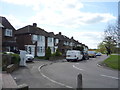

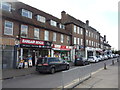
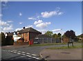
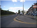
21 photos from this area
Area Information
Key information about the EN6 3DE including its size, population, and administrative classification.
- Area Type
- Postcode
- Area Size
- 8591 m²
- Population
- 2077
- Population Density
- 689 people/km²
House Prices in EN6 3DE
22
Properties
£383,721
Average Sold Price
£74,500
Lowest Price
£635,000
Highest Price
Showing 22 properties
| Address | Type | Beds | Baths | Last Sale Price | Last Sale Date | |
|---|---|---|---|---|---|---|
| 82 Deepdene, Potters Bar, EN6 3DE | house | - | - | £500,000 | Jan 2023 | |
| 72 Deepdene, Potters Bar, EN6 3DE | Semi-detached | 3 | 1 | £612,000 | Dec 2022 | |
| 74 Deepdene, Potters Bar, EN6 3DE | house | - | - | £537,500 | Nov 2022 | |
| 50 Deepdene, Potters Bar, EN6 3DE | Semi-detached | 3 | 1 | £635,000 | May 2022 | |
| 70 Deepdene, Potters Bar, EN6 3DE | Semi-detached | 4 | 1 | £595,000 | Sep 2021 | |
| 64 Deepdene, Potters Bar, EN6 3DE | Semi-detached | 4 | 2 | £609,000 | Dec 2020 | |
| 58 Deepdene, Potters Bar, EN6 3DE | Semi-detached | 3 | 1 | £525,000 | Sep 2020 | |
| 52 Deepdene, Potters Bar, EN6 3DE | Semi-detached | 4 | 2 | £530,000 | Aug 2018 | |
| 92 Deepdene, Potters Bar, EN6 3DE | Semi-detached | 3 | 1 | £590,000 | Dec 2016 | |
| 80 Deepdene, Potters Bar, EN6 3DE | Semi-detached | 3 | - | £333,000 | Jan 2014 |
Page 1 of 3
Energy Efficiency in EN6 3DE
Amenities
Schools
| Rank | School | Type | Entry gender | Ages |
|---|
Explore more schools in this area
Go to Schools tabDemographics
Household Size
Family (3-5 people)
most common
Accommodation Type
Houses
most common
Tenure
92
majority
Ethnic Group
White
most common
Religion
N/A
most common
Household Composition
N/A
most common
Age
47
median
Adults (30-64 years)
most common
Household Deprivation
N/A
with no deprivation
NS-SEC
44
in Lower managerial occupations
Explore more demographic insights in this area
Go to Demographics tabPlanning
Planning Constraints
- Flood RiskPremium
- Ramsar Wetland SitesPremium
- Area of Outstanding Natural BeautyPremium
- Protected Nature ReservePremium
- Protected WoodlandPremium