Area Overview for EN5 4AN
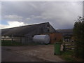
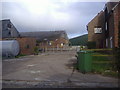
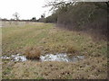
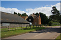
Photos of EN5 4AN


Area Information
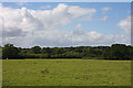
EN5 4AN is a small, compact postcode area in England, spanning 12.6 hectares and home to 1,066 residents. Its low population density of 51 people per square kilometre suggests a quiet, residential character, likely centred around a cluster of homes rather than sprawling development. This area is not a sprawling suburb but a tightly knit community, with homes predominantly in the form of houses rather than flats. Daily life here is likely shaped by proximity to local amenities, with the area’s small size meaning residents can access nearby services without long commutes. The demographic profile—skewed toward adults aged 30–64—hints at a community of established professionals or families, with a strong emphasis on home ownership, which accounts for 61% of properties. While the area lacks major landmarks or natural features, its modest scale and focus on housing make it a practical choice for those prioritising privacy and a slower pace of life. Living in EN5 4AN means navigating a small, manageable environment where local needs are met by nearby retail, transport, and schools, though the area’s size limits its diversity of offerings.
- Area Type
- Postcode
- Area Size
- 12.6 hectares
- Population
- 1066
- Population Density
- 51 people/km²
The property market in EN5 4AN is dominated by owner-occupied homes, with 61% of properties owned by residents rather than rented. This suggests a community of long-term residents rather than transient tenants, which can contribute to a sense of continuity and local identity. The accommodation type is exclusively houses, which is unusual for a small postcode area but may indicate a focus on semi-detached or detached properties. Given the area’s size of 12.6 hectares and population of 1,066, the housing stock is likely limited in volume, meaning the market is not expansive. Buyers should consider that the small scale of the area may restrict property choices, though the emphasis on home ownership could mean a stable, low-turnover market. For those seeking a house in EN5 4AN, the focus on owner-occupation suggests a buyer-driven environment where properties may retain value over time. The immediate surroundings may offer additional options, but the area itself is not a hub for large-scale development.
House Prices in EN5 4AN
Showing 1 properties
| Address | Type | Beds | Baths | Last Sale Price | Last Sale Date | |
|---|---|---|---|---|---|---|
| Poor Clare Monastery, Galley Lane, Barnet, EN5 4AN | commercial | - | - | - | - |
Energy Efficiency in EN5 4AN
Residents of EN5 4AN have access to a range of nearby amenities, including five retail outlets such as M&S Clarendon Borehamwood BP, Morrisons Daily, and Lidl Elstree, which cater to everyday shopping needs. The area’s transport links—five metro stations, including High Barnet and Totteridge & Whetstone, and rail stations like Elstree & Borehamwood—connect residents to broader networks, facilitating access to leisure, employment, and cultural opportunities beyond the immediate postcode. While the data does not specify parks or recreational spaces, the absence of protected natural areas or constraints suggests a focus on residential living rather than green spaces. The lifestyle here is likely convenience-driven, with local shops and transport hubs meeting daily needs, though the small area size means the range of amenities is limited.
Amenities
Schools
The nearest school to EN5 4AN is St Giles’ CofE Primary School, a primary institution with an Ofsted rating of ‘good’. This school serves the local community, providing education for younger children within walking distance for many residents. The absence of secondary schools in the data means families with older children may need to look beyond the immediate area for secondary education. The presence of a primary school with a positive rating suggests a baseline level of educational provision, though the lack of further details on school capacity or performance means its suitability for specific families cannot be fully assessed. For those prioritising proximity to schools, St Giles’ CofE Primary School offers a practical option, but the area’s small size may limit the range of educational choices available.
| Rank | School | Type | Entry gender | Ages |
|---|
Explore more schools in this area
Go to Schools tabDemographics
The community in EN5 4AN is predominantly composed of adults aged 30–64, reflecting a mature, stable population with a median age of 47. This age group suggests a mix of families with children and older professionals, though the lack of specific data on household types means assumptions about family structures remain cautious. Home ownership is strong, with 61% of residents owning their homes, indicating a preference for long-term settlement over rental living. The accommodation type is primarily houses, which aligns with the area’s low density and residential focus. The predominant ethnic group is White, though no further breakdown of diversity is provided. The population density of 51 people per square kilometre ensures a low-pressure environment, reducing competition for local resources. However, the absence of data on deprivation levels means the area’s socioeconomic challenges cannot be assessed. For those prioritising stability and a settled lifestyle, EN5 4AN’s demographic profile offers a predictable, family-friendly backdrop.
Household Size
Accommodation Type
Tenure
Ethnic Group
Religion
Household Composition
Age
Household Deprivation
NS-SEC
Explore more demographic insights in this area
Go to Demographics tabPlanning
Planning Constraints
- Flood RiskPremium
- Ramsar Wetland SitesPremium
- Area of Outstanding Natural BeautyPremium
- Protected Nature ReservePremium
- Protected WoodlandPremium