Area Overview for EN11 9LU
Photos of EN11 9LU
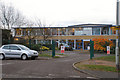
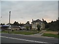
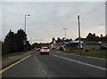
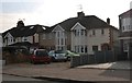
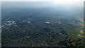
9 photos from this area
Area Information
Key information about the EN11 9LU including its size, population, and administrative classification.
- Area Type
- Postcode
- Area Size
- 1.0 hectares
- Population
- 2680
- Population Density
- 5460 people/km²
House Prices in EN11 9LU
21
Properties
£292,342
Average Sold Price
£97,955
Lowest Price
£600,000
Highest Price
Showing 21 properties
| Address | Type | Beds | Baths | Last Sale Price | Last Sale Date | |
|---|---|---|---|---|---|---|
| 27 Danemead, Hoddesdon, EN11 9LU | Semi-detached | 3 | 2 | £600,000 | Jul 2025 | |
| 44 Danemead, Hoddesdon, EN11 9LU | Semi-detached | 3 | 1 | £424,000 | Feb 2020 | |
| 30 Danemead, Hoddesdon, EN11 9LU | house | - | - | £409,000 | Oct 2016 | |
| 47 Danemead, Hoddesdon, EN11 9LU | Semi-detached | 3 | - | £275,000 | Mar 2012 | |
| 33 Danemead, Hoddesdon, EN11 9LU | house | - | - | £334,000 | Dec 2010 | |
| 32 Danemead, Hoddesdon, EN11 9LU | house | - | - | £250,000 | Aug 2010 | |
| 31 Danemead, Hoddesdon, EN11 9LU | house | - | - | £270,000 | Feb 2010 | |
| 48 Danemead, Hoddesdon, EN11 9LU | Detached | - | - | £345,000 | Jun 2008 | |
| 49 Danemead, Hoddesdon, EN11 9LU | Semi-detached | - | - | £249,995 | Apr 2007 | |
| 34 Danemead, Hoddesdon, EN11 9LU | Semi-detached | 5 | 3 | £248,500 | Apr 2004 |
Page 1 of 3
Energy Efficiency in EN11 9LU
Amenities
Schools
| Rank | School | Type | Entry gender | Ages |
|---|
Explore more schools in this area
Go to Schools tabDemographics
Household Size
Family (3-5 people)
most common
Accommodation Type
Houses
most common
Tenure
76
majority
Ethnic Group
White
most common
Religion
N/A
most common
Household Composition
N/A
most common
Age
47
median
Adults (30-64 years)
most common
Household Deprivation
N/A
with no deprivation
NS-SEC
33
in Lower managerial occupations
Explore more demographic insights in this area
Go to Demographics tabPlanning
Planning Constraints
- Flood RiskPremium
- Ramsar Wetland SitesPremium
- Area of Outstanding Natural BeautyPremium
- Protected Nature ReservePremium
- Protected WoodlandPremium