Area Overview for EN11 8RY
Photos of EN11 8RY
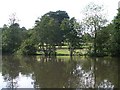
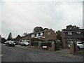
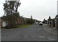
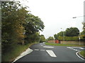
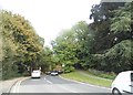
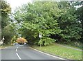
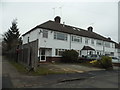
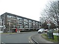
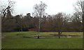
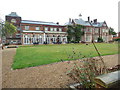
23 photos from this area
Area Information
Key information about the EN11 8RY including its size, population, and administrative classification.
- Area Type
- Postcode
- Area Size
- 5211 m²
- Population
- 1725
- Population Density
- 5334 people/km²
House Prices in EN11 8RY
25
Properties
£242,571
Average Sold Price
£169,995
Lowest Price
£405,000
Highest Price
Showing 25 properties
| Address | Type | Beds | Baths | Last Sale Price | Last Sale Date | |
|---|---|---|---|---|---|---|
| 5 Langton Road, Hoddesdon, EN11 8RY | Terraced | 3 | 1 | £405,000 | May 2022 | |
| 3 Langton Road, Hoddesdon, EN11 8RY | house | - | - | £323,010 | Apr 2021 | |
| 11 Langton Road, Hoddesdon, EN11 8RY | Terraced | 3 | 1 | £210,000 | Aug 2013 | |
| 17 Langton Road, Hoddesdon, EN11 8RY | Terraced | 3 | 2 | £185,000 | Aug 2010 | |
| 15 Langton Road, Hoddesdon, EN11 8RY | Terraced | - | - | £205,000 | Aug 2007 | |
| 21 Langton Road, Hoddesdon, EN11 8RY | Terraced | - | - | £199,995 | Nov 2006 | |
| 1 Langton Road, Hoddesdon, EN11 8RY | Terraced | - | - | £169,995 | Aug 2003 | |
| 19 Langton Road, Hoddesdon, EN11 8RY | Terraced | - | - | - | - | |
| 22 Langton Road, Hoddesdon, EN11 8RY | Maisonette | - | - | - | - | |
| 26 Langton Road, Hoddesdon, EN11 8RY | Maisonette | - | - | - | - |
Page 1 of 3
Energy Efficiency in EN11 8RY
Amenities
Schools
| Rank | School | Type | Entry gender | Ages |
|---|
Explore more schools in this area
Go to Schools tabDemographics
Household Size
One person
most common
Accommodation Type
Flats
most common
Tenure
40
majority
Ethnic Group
White
most common
Religion
N/A
most common
Household Composition
N/A
most common
Age
47
median
Adults (30-64 years)
most common
Household Deprivation
N/A
with no deprivation
NS-SEC
24
in Lower managerial occupations
Explore more demographic insights in this area
Go to Demographics tabPlanning
Planning Constraints
- Flood RiskPremium
- Ramsar Wetland SitesPremium
- Area of Outstanding Natural BeautyPremium
- Protected Nature ReservePremium
- Protected WoodlandPremium