Area Overview for EN11 8RF
Photos of EN11 8RF

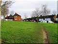
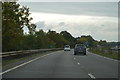
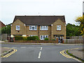
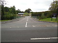
11 photos from this area
Area Information
Key information about the EN11 8RF including its size, population, and administrative classification.
- Area Type
- Postcode
- Area Size
- 8472 m²
- Population
- 1949
- Population Density
- 441 people/km²
House Prices in EN11 8RF
24
Properties
£302,250
Average Sold Price
£222,000
Lowest Price
£487,500
Highest Price
Showing 24 properties
| Address | Type | Beds | Baths | Last Sale Price | Last Sale Date | |
|---|---|---|---|---|---|---|
| 36 Norris Rise, Hoddesdon, EN11 8RF | Terraced | 3 | 2 | £470,000 | Aug 2025 | |
| 46 Norris Rise, Hoddesdon, EN11 8RF | house | - | - | £305,000 | Apr 2021 | |
| 44 Norris Rise, Hoddesdon, EN11 8RF | house | 2 | 1 | £487,500 | Mar 2021 | |
| 18 Norris Rise, Hoddesdon, EN11 8RF | Semi-detached | 2 | 1 | £305,000 | Jul 2020 | |
| 26 Norris Rise, Hoddesdon, EN11 8RF | house | - | - | £275,000 | Jul 2015 | |
| 16 Norris Rise, Hoddesdon, EN11 8RF | Semi-detached | 3 | 1 | £245,000 | Mar 2014 | |
| 22 Norris Rise, Hoddesdon, EN11 8RF | Semi-detached | 3 | - | £240,000 | Jan 2014 | |
| 4 Norris Rise, Hoddesdon, EN11 8RF | house | - | - | £225,000 | Jul 2013 | |
| 34 Norris Rise, Hoddesdon, EN11 8RF | Semi-detached | 3 | 1 | £248,000 | Sep 2012 | |
| 30 Norris Rise, Hoddesdon, EN11 8RF | Semi-detached | - | - | £222,000 | Nov 2003 |
Page 1 of 3
Energy Efficiency in EN11 8RF
Amenities
Schools
| Rank | School | Type | Entry gender | Ages |
|---|
Explore more schools in this area
Go to Schools tabDemographics
Household Size
Family (3-5 people)
most common
Accommodation Type
Houses
most common
Tenure
65
majority
Ethnic Group
White
most common
Religion
N/A
most common
Household Composition
N/A
most common
Age
47
median
Adults (30-64 years)
most common
Household Deprivation
N/A
with no deprivation
NS-SEC
31
in Lower managerial occupations
Explore more demographic insights in this area
Go to Demographics tabPlanning
Planning Constraints
- Flood RiskPremium
- Ramsar Wetland SitesPremium
- Area of Outstanding Natural BeautyPremium
- Protected Nature ReservePremium
- Protected WoodlandPremium