Area Overview for EN11 0LX
Photos of EN11 0LX
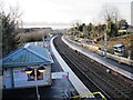

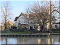
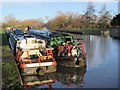
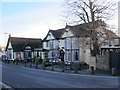
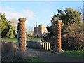
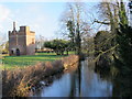
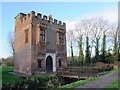
75 photos from this area
Area Information
Key information about the EN11 0LX including its size, population, and administrative classification.
- Area Type
- Postcode
- Area Size
- 1.2 hectares
- Population
- 1380
- Population Density
- 4599 people/km²
House Prices in EN11 0LX
29
Properties
£306,738
Average Sold Price
£68,000
Lowest Price
£465,000
Highest Price
Showing 29 properties
| Address | Type | Beds | Baths | Last Sale Price | Last Sale Date | |
|---|---|---|---|---|---|---|
| 99 Old Highway, Hoddesdon, EN11 0LX | Terraced | 2 | 1 | £317,000 | Feb 2024 | |
| 79 Old Highway, Hoddesdon, EN11 0LX | house | 3 | - | £325,000 | Dec 2021 | |
| 113 Old Highway, Hoddesdon, EN11 0LX | house | 3 | - | £370,000 | Aug 2021 | |
| 71 Old Highway, Hoddesdon, EN11 0LX | Detached | 3 | 2 | £387,500 | Jul 2021 | |
| 97 Old Highway, Hoddesdon, EN11 0LX | house | 2 | - | £290,000 | Jun 2021 | |
| 75 Old Highway, Hoddesdon, EN11 0LX | house | - | - | £330,000 | Mar 2021 | |
| 107 Old Highway, Hoddesdon, EN11 0LX | house | - | - | £430,000 | Mar 2021 | |
| 115 Old Highway, Hoddesdon, EN11 0LX | Terraced | 5 | 1 | £465,000 | Mar 2021 | |
| 89 Old Highway, Hoddesdon, EN11 0LX | Terraced | 3 | 1 | £280,000 | Aug 2020 | |
| 1, The Willows, Old Highway, Hoddesdon, EN11 0LX | house | - | - | £400,000 | Jun 2020 |
Page 1 of 3
Energy Efficiency in EN11 0LX
Amenities
Schools
| Rank | School | Type | Entry gender | Ages |
|---|
Explore more schools in this area
Go to Schools tabDemographics
Household Size
Family (3-5 people)
most common
Accommodation Type
Houses
most common
Tenure
75
majority
Ethnic Group
White
most common
Religion
N/A
most common
Household Composition
N/A
most common
Age
47
median
Adults (30-64 years)
most common
Household Deprivation
N/A
with no deprivation
NS-SEC
30
in Lower managerial occupations
Explore more demographic insights in this area
Go to Demographics tabPlanning
Planning Constraints
- Flood RiskPremium
- Ramsar Wetland SitesPremium
- Area of Outstanding Natural BeautyPremium
- Protected Nature ReservePremium
- Protected WoodlandPremium