Area Overview for EN11 0JR
Photos of EN11 0JR
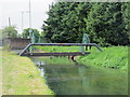
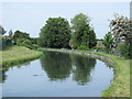
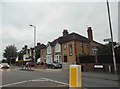
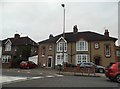
27 photos from this area
Area Information
Key information about the EN11 0JR including its size, population, and administrative classification.
- Area Type
- Postcode
- Area Size
- 1.5 hectares
- Population
- 1358
- Population Density
- 6773 people/km²
House Prices in EN11 0JR
17
Properties
£166,000
Average Sold Price
£65,000
Lowest Price
£315,000
Highest Price
Showing 17 properties
| Address | Type | Beds | Baths | Last Sale Price | Last Sale Date | |
|---|---|---|---|---|---|---|
| 143 Rye Road, Hoddesdon, EN11 0JR | Semi-detached | 3 | 1 | £315,000 | Jul 2017 | |
| 137 Rye Road, Hoddesdon, EN11 0JR | Semi-detached | 3 | 2 | £215,000 | Sep 2007 | |
| 139 Rye Road, Hoddesdon, EN11 0JR | house | - | - | £105,000 | Mar 2000 | |
| 131 Rye Road, Hoddesdon, EN11 0JR | Detached | - | - | £130,000 | Oct 1999 | |
| 141 Rye Road, Hoddesdon, EN11 0JR | house | - | - | £65,000 | Jan 1995 | |
| Flat 2, Sheffield House, Rye Road, Hoddesdon, EN11 0JR | Flat | 2 | 1 | - | - | |
| Flat 3, Sheffield House, Rye Road, Hoddesdon, EN11 0JR | Flat | - | - | - | - | |
| Flat 4, Sheffield House, Rye Road, Hoddesdon, EN11 0JR | Flat | - | - | - | - | |
| 155 Rye Road, Hoddesdon, EN11 0JR | Terraced | - | - | - | - | |
| 161 Rye Road, Hoddesdon, EN11 0JR | Terraced | - | - | - | - |
Page 1 of 2
Energy Efficiency in EN11 0JR
Amenities
Schools
| Rank | School | Type | Entry gender | Ages |
|---|
Explore more schools in this area
Go to Schools tabDemographics
Household Size
Family (3-5 people)
most common
Accommodation Type
Houses
most common
Tenure
74
majority
Ethnic Group
White
most common
Religion
N/A
most common
Household Composition
N/A
most common
Age
47
median
Adults (30-64 years)
most common
Household Deprivation
N/A
with no deprivation
NS-SEC
26
in Lower managerial occupations
Explore more demographic insights in this area
Go to Demographics tabPlanning
Planning Constraints
- Flood RiskPremium
- Ramsar Wetland SitesPremium
- Area of Outstanding Natural BeautyPremium
- Protected Nature ReservePremium
- Protected WoodlandPremium