Area Overview for EN10 7QJ
Photos of EN10 7QJ
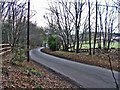
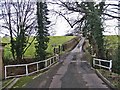
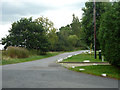
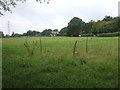
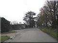
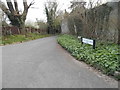
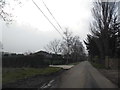
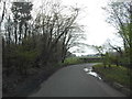
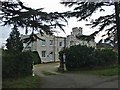
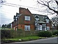
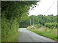
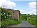
15 photos from this area
Area Information
Key information about the EN10 7QJ including its size, population, and administrative classification.
- Area Type
- Postcode
- Area Size
- 1.3 km²
- Population
- 1514
- Population Density
- 258 people/km²
House Prices in EN10 7QJ
19
Properties
£770,875
Average Sold Price
£285,000
Lowest Price
£1,385,000
Highest Price
Showing 19 properties
| Address | Type | Beds | Baths | Last Sale Price | Last Sale Date | |
|---|---|---|---|---|---|---|
| Beaumont Manor Farm, Beaumont Road, Wormley, EN10 7QJ | Detached | 4 | 2 | £1,287,000 | Jun 2019 | |
| The White House, Beaumont Road, Wormley, EN10 7QJ | Detached | 4 | 3 | £1,075,000 | Mar 2017 | |
| Hunters, Beaumont Road, Wormley, EN10 7QJ | house | - | - | £1,385,000 | Jun 2010 | |
| 1, Beaumont Manor, Beaumont Road, Wormley, EN10 7QJ | Detached | 4 | 2 | £625,000 | Oct 2009 | |
| The Cottage, Beaumont Road, Wormley, EN10 7QJ | Detached | - | - | £390,000 | Sep 2002 | |
| Barrett Lodge, Beaumont Road, Wormley, EN10 7QJ | Detached | - | - | £660,000 | Apr 2001 | |
| Beaumont Oak, Beaumont Road, Wormley, EN10 7QJ | Detached | 4 | 3 | £460,000 | Aug 1999 | |
| 3, Beaumont Manor, Beaumont Road, Wormley, EN10 7QJ | Semi-detached | - | - | £285,000 | Jun 1997 | |
| Wyndcroft, Beaumont Road, Wormley, EN10 7QJ | Semi-detached | 4 | 2 | - | - | |
| 2, Beaumont Manor, Beaumont Road, Wormley, EN10 7QJ | Terraced | 6 | 2 | - | - |
Page 1 of 2
Energy Efficiency in EN10 7QJ
Amenities
Schools
| Rank | School | Type | Entry gender | Ages |
|---|
Explore more schools in this area
Go to Schools tabDemographics
Household Size
Family (3-5 people)
most common
Accommodation Type
Houses
most common
Tenure
88
majority
Ethnic Group
White
most common
Religion
N/A
most common
Household Composition
N/A
most common
Age
47
median
Adults (30-64 years)
most common
Household Deprivation
N/A
with no deprivation
NS-SEC
37
in Lower managerial occupations
Explore more demographic insights in this area
Go to Demographics tabPlanning
Planning Constraints
- Flood RiskPremium
- Ramsar Wetland SitesPremium
- Area of Outstanding Natural BeautyPremium
- Protected Nature ReservePremium
- Protected WoodlandPremium