Area Overview for EN10 7PZ
Photos of EN10 7PZ
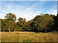
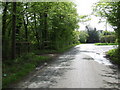
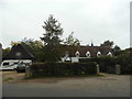
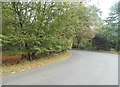
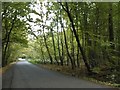
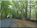
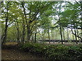
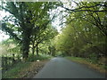
28 photos from this area
Area Information
Key information about the EN10 7PZ including its size, population, and administrative classification.
- Area Type
- Postcode
- Area Size
- 24.1 hectares
- Population
- 1560
- Population Density
- 732 people/km²
House Prices in EN10 7PZ
13
Properties
£967,100
Average Sold Price
£147,000
Lowest Price
£1,750,000
Highest Price
Showing 13 properties
| Address | Type | Beds | Baths | Last Sale Price | Last Sale Date | |
|---|---|---|---|---|---|---|
| Lisand Farm, White Stubbs Lane, Broxbourne, EN10 7PZ | house | - | - | £1,750,000 | Mar 2022 | |
| The Old Forge, White Stubbs Lane, Broxbourne, EN10 7PZ | Detached | 4 | 4 | £1,286,000 | Aug 2021 | |
| Home Farm Cottage, White Stubbs Lane, Broxbourne, EN10 7PZ | house | 3 | - | £552,500 | Aug 2004 | |
| Cold Hall, White Stubbs Lane, Broxbourne, EN10 7PZ | Detached | - | - | £1,100,000 | Mar 2002 | |
| Fairwinds, White Stubbs Lane, Broxbourne, EN10 7PZ | Detached | 4 | - | £147,000 | Jul 1995 | |
| Bungalow, Highfield Stables, White Stubbs Lane, Broxbourne, EN10 7PZ | Detached | 5 | 4 | - | - | |
| Pemberly Ash, White Stubbs Lane, Broxbourne, EN10 7PZ | Detached | 5 | 4 | - | - | |
| Home Farm, White Stubbs Lane, Broxbourne, EN10 7PZ | Detached | 4 | 2 | - | - | |
| Little Grove Lodge Broxbournebury, White Stubbs Lane, Broxbourne, EN10 7PZ | Detached | 5 | 2 | - | - | |
| Kimble, Highfield Stables, White Stubbs Lane, Broxbourne, EN10 7PZ | Bungalow | 4 | 2 | - | - |
Page 1 of 2
Energy Efficiency in EN10 7PZ
Amenities
Schools
| Rank | School | Type | Entry gender | Ages |
|---|
Explore more schools in this area
Go to Schools tabDemographics
Household Size
Family (3-5 people)
most common
Accommodation Type
Houses
most common
Tenure
96
majority
Ethnic Group
White
most common
Religion
N/A
most common
Household Composition
N/A
most common
Age
47
median
Adults (30-64 years)
most common
Household Deprivation
N/A
with no deprivation
NS-SEC
48
in Lower managerial occupations
Explore more demographic insights in this area
Go to Demographics tabPlanning
Planning Constraints
- Flood RiskPremium
- Ramsar Wetland SitesPremium
- Area of Outstanding Natural BeautyPremium
- Protected Nature ReservePremium
- Protected WoodlandPremium