Area Overview for Emneth & Outwell Ward
Photos of Emneth & Outwell Ward
Area Information
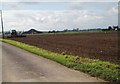
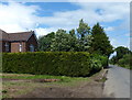
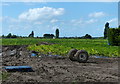
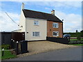
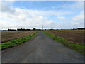
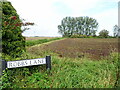
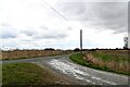
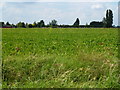
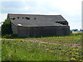
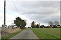
Living in Emneth & Outwell Ward offers a distinctly rural experience within Norfolk, covering an area of 24 km². The ward encompasses the villages of Emneth and Outwell, situated in the East of England region. Emneth lies 2.9 miles south-east of Wisbech and 46 miles west of Norwich. The location is bisected by the A47 motorway, providing a direct route between Birmingham and Lowestoft. You are close to the River Nene, which shapes the local landscape. The village lacks the modern infrastructure of larger towns but retains deep historical roots. Emneth's name derives from Anglo-Saxon Old English, referring to Eana's meeting place or meadow. The area was not recorded in the Domesday Book of 1086, likely due to historical flooding. Hagbeach Hall, a medieval manor house, stood here until its demolition in 1887. A railway station once served the village, opening in 1848 and closing in 1968. Today, St Edmund's Church stands as a fifteenth-century Grade I listed building in the heart of Emneth. The war memorial, a stone column with a Celtic cross, remains a focal point in the churchyard. It was unveiled in 1920 and lists local casualties from the First World War. Residents here enjoy a quiet life defined by historical architecture and proximity to the A47. The nearest current railway connection is Downham Market on the Fen Line. Pitching a life in this specific ward means accepting a village atmosphere while maintaining reasonable road access to the wider county.
- Area Type
- District Borough Unitary Ward
- Area Size
- 24.0 km²
- Population
- Not available
- Population Density
- Not available
Demographics
The community in Emneth & Outwell Ward is defined by a significantly older population profile. You will find that the median age for residents is 70 years old. This statistic reflects a neighbourhood dominated by older generations rather than young families or first-time buyers. The most common age range corresponds to the total population, indicating a uniform skew towards senior living. Home ownership is extremely prevalent, with 76% of occupants owning their property outright. This high figure suggests a stable, established community where residents have long-term ties to the locality. You will encounter few renting households within this specific domain. The ward represents a classic example of a retirement or semi-retirement village in Norfolk. Diversity in ethnic composition, religious adherence, and accommodation types does not appear to be a defining feature based on available local records. The demographic reality is a quiet, homogeneous populace centred on older age groups. This profile influences the local service provision, with a strong emphasis on health and leisure facilities suitable for seniors. When considering Emneth & Outwell Ward, you are entering an area where the demographic weight is heavily balanced towards older, owner-occupying residents. The lack of younger families may mean fewer demand for primary schooling services immediately within the immediate vicinity.
Household Size
Accommodation Type
Tenure
Ethnic Group
Religion
Household Composition
Age
Household Deprivation
NS-SEC
Explore more demographic insights in this area
Go to Demographics tabPlanning
Planning Constraints
- Flood RiskPremium
- Ramsar Wetland SitesPremium
- Area of Outstanding Natural BeautyPremium
- Protected Nature ReservePremium
- Protected WoodlandPremium
- Crime RiskPremium