Area Overview for Ely West Ward
Photos of Ely West Ward


Area Information
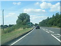
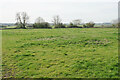
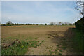
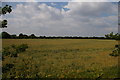
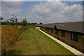
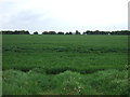
Ely West Ward stands as a distinct district within the borough, covering a total area of 10.7 km². With a recorded population of 1,903 residents, this undersized locality offers a quiet residential setting rather than a bustling hub. The low population density of 177 people per square kilometre defines daily life here. You will find a community spread thin across the landscape, which results in spacious surroundings and a calm atmosphere. Living in Ely West Ward means embracing a lifestyle far removed from the density of larger urban centres. The ward functions as a self-contained neighbourhood where community interactions rely on proximity and established local connections rather than urban infrastructure. This scarcity of people creates a singular environment suited to those seeking isolation or a retreat from city noise. The small footprint means that distance between homes is significant, fostering a sense of privacy and exclusivity. You should expect a residential experience characterised by open space and limited foot traffic. The area suits individuals who value tranquility over accessibility to major metropolitan amenities. Every aspect of daily life reflects this low-density reality, from the quiet streets to the lack of crowded public spaces. Ely West Ward remains a specific choice for buyers prioritising space and silence.
- Area Type
- District Borough Unitary Ward
- Area Size
- 10.7 km²
- Population
- 1903
- Population Density
- 177 people/km²
Demographics
The community in Ely West Ward displays a clear demographic lean towards older residents. The median age sits at 70 years old, indicating that the area is dominated by retirees or established households. This age profile suggests a population that has been settled for a long time. You will primarily encounter a mature demographic rather than young families or recent migrants. The age data points to a stable social structure where long-standing residents define the social fabric. Home ownership levels within the ward reach a high 69%, confirming that the majority of households buy their homes rather than rent. This statistic aligns perfectly with the older age profile, as older residents often own their properties outright or through traditional mortgage arrangements. Most of the 1,903 residents likely live in accommodation they have built up over decades of residence. The high ownership rate reduces the presence of student housing or short-term rental properties that often characterise younger, dynamic areas. Living in Ely West Ward means joining a community where financial independence regarding housing is the norm. You can expect a neighbourhood driven by long-term owners who have deep roots in the locality.
Household Size
Accommodation Type
Tenure
Ethnic Group
Religion
Household Composition
Age
Household Deprivation
NS-SEC
Explore more demographic insights in this area
Go to Demographics tabPlanning
Planning Constraints
- Flood RiskPremium
- Ramsar Wetland SitesPremium
- Area of Outstanding Natural BeautyPremium
- Protected Nature ReservePremium
- Protected WoodlandPremium
- Crime RiskPremium